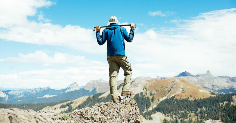
Looking for the best hikes in Colorado? You’ve come to the right place. While exploring trails in the state, you’ve no doubt heard the following recommendations:
- Hanging Lake Trail, Glenwood Springs
- Perimeter Trail, Ouray
- Garden of the Gods Loop, Colorado Springs
- Dream Lake, Rocky Mountain National Park
- Royal Arch Trail, Boulder
- Crater Lake Trail, Maroon Bells
- Flatirons Hike, Boulder
- Maroon Bells Scenic Loop Trail, Aspen
- Devil’s Head Lookout, Colorado Springs
- Mount Bierstadt Trail, Silver Plume
- Alderfer Three Sisters Trail, Evergreen
No doubt about it—these are some of the best hikes in Colorado. However, everyone knows about them. Visit any of these trails any time of the year, and you won’t find much solace. And solace is what makes hiking the best…if you’re into that kind of thing.
If you’re new to Colorado or just visiting, sure, go for the classic hikes. You’ll find a crowd, but the crowd is there for a reason. However, if you’re a resident or just looking to try something new, the list below is for you.
I’m going to give you a local’s recommendations for the best hikes in Colorado. I’ve hiked and mountain biked all over the state, bagging peaks (random and popular), crossing rivers, and exploring the unexplored. I’ve done the touristy hikes and the nobody-has-been-on-this-trail-in-a-decade hikes.
Want to go off the beaten path a bit and discover Colorado’s true best hikes? Lace up your hiking boots, and let’s do this.
Best Hikes in Colorado
1. Bridge of Heaven, Ouray
- Route: Out-and-back
- Distance: 8.0 miles
- Elevation: 3,000 feet
- Difficulty: Hard
The Bridge of Heaven is an airy vantage point above the town of Ouray with incredible views of the San Juan Mountains, especially the Sneffels Range and 14’ers (14-thousand-foot peaks) Wetterhorn and Uncompaghre. There are a half dozen ways to get up to the Bridge of Heaven (many not on official trails), but the best way is up the New Horsethief Trail above Dexter Creek.
This trail stretches out the hike a bit longer, but it puts your average climbing gradient at a more manageable level. Plus, you spend the first half meandering through thick aspen groves with intermittent glimpses of the surrounding mountain beauty. Eventually, you top out on a grassy meadow with views of Ouray before you follow the remainder of the ridge to the Bridge of Heaven.
2. South Colony Lakes, Sangre de Cristo Range
- Route: Out-and-back
- Distance: 9.0 miles
- Elevation gain: 2,300 feet
- Difficulty: Moderate
As you begin your ascent from the South Colony Lakes Campground, you’ll pass through a shady forest, gradually opening up to reveal vibrant alpine meadows filled with wildflowers during the summer months. Eventually, you’ll reach the Lower South Colony Lake and get breathtaking views of Crestone Needle.
There are plenty of campsites around this area if you want to make it a backpacking trip, but it’s first-come, first-served. Take a break, refuel on food, and get ready for a little bit more climbing as you make your way to the Upper South Colony Lake. This has even better views of Crestone Needle and now Crestone Peak, and you’ll find a trail that leads up to Humboldt Peak if you want to bag one of the easiest 14’ers in the state.
3. Lost Creek Wilderness Loop, Lost Creek Wilderness
- Route: Loop
- Distance: 28.0 miles
- Elevation gain: 5,500 feet
- Difficulty: Hard
The Lost Creek Wilderness Loop is a captivating backpacking adventure that takes you through some of Colorado’s most diverse (and dense) landscapes. Start at the Goose Creek Trailhead. You’ll see some of the most unique granite rock formations and cross babbling creeks as you make your way into the heart of this remote wilderness.
And it feels remote.
Every time I’ve hiked in the Lost Creek Wilderness, I’ve only seen a handful of other hikers. That might just be my luck, or it could be that it’s just far enough away from the Front Range to deter day hikers.
4. Island Lake, Silverton
- Route: Out-and-back
- Distance: 7.7 miles
- Elevation gain: 2,680 feet
- Difficulty: Moderate
There are plenty of ways to reach Island Lake, but my favorite is from South Mineral Campground. You’ll get to pass a handful of amazing waterfalls on this route, and you can also stop at the almost-as-impressive Ice Lakes on the way up (or down).
Island Lake seems like one of the most photographed lakes in the state, but it’s not one of the most visited. Get an early start in the morning, and you might have most of the trail to yourself in this remote part of the San Juan Mountains.
5. Mirror Lake, Indians Peaks Wilderness
- Route: Out-and-back
- Distance: 15.0 miles
- Elevation gain: 2,300 feet
- Difficulty: Moderate
The Cascade Creek Trail to Mirror Lake (and Crater Lake) takes you to some of the most stunning backcountry wilderness in the state. Lone Eagle Peak looms above the lakes, creating a picture-perfect reflection across the water.
You’ll find joy in the journey (that’s for sure), but the destination is something else. Whether you decide to camp nearby (with a backpacking permit) or attempt Lone Eagle, you won’t regret taking this voyage into the Indian Peaks Wilderness.
While you might see some other hikers, there’s significantly more traffic on the other side of the range coming from Brainard Lake. If you want solitude, this is the route to go.
6. High Dune Trail, Great Sand Dunes National Park
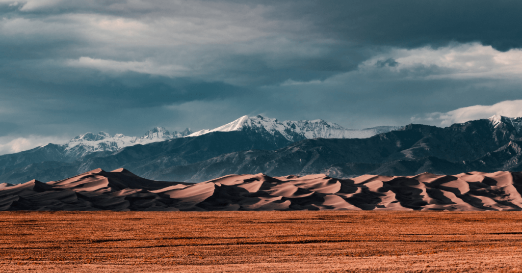
- Route: Out-and-back
- Distance: 3.0 miles
- Elevation gain: 600 feet
- Difficulty: Moderate
The trailhead begins at the Dunes Parking Lot, and from the start, you’ll be surrounded by vast expanses of sand dunes tucked in front of the towering peaks of the Sangre de Cristo Range.
As you venture into the dunes, be prepared for a sandy and strenuous hike. The soft sand makes each step more challenging, requiring extra effort and balance. Pack more water than you’ll think you need.
I know it’s just 3 miles…but under a beating sun and loose sand, it can take its toll. The final ascent takes you to the High Dune, one of the tallest dunes in the park. Standing atop this majestic sand peak, you’ll be treated to 360 views of the mountains, dunes, and San Luis Valley.
On your way back, you can choose to follow the same path or explore different sections of the dunes. It’s a playground made out of sand—a true build-your-own adventure. Consider taking a sandboard or sled up to accelerate your way down.
In theory, it’s a good idea. In practice, well…you’ll just have to see for yourself.
7. See Forever Trail, Telluride
- Route: Out-and-back
- Distance: 5.0 miles
- Elevation gain: 1,700 feet
- Difficulty: Moderate
The See Forever Trail in Telluride is a captivating hike that lives up to its name, offering awe-inspiring views that seem to stretch forever. You can find free parking in downtown Telluride or Mountain Village—take your pic. The trail begins at the top of the gondola in Telluride, where you’ll be instantly greeted by breathtaking views of the surrounding mountains and valleys.
Follow the well-marked trail as it winds its way along the mountain ridgeline, giving you amazing views of the Wilsons Range, Palmyra Peak, and practically every other mountain in Southwest Colorado.
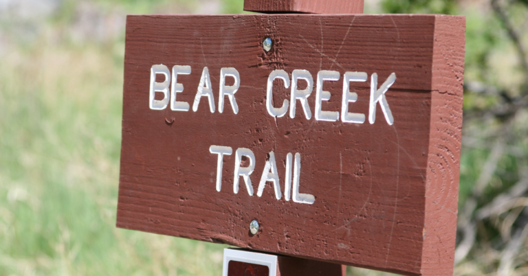
The trail eventually ends at the top of the Revelation Lift, where you can soak in the incredible vistas before making your way back down. Want to make it a loop? Continue southeast down the trail before making your way north along the Bear Creek trail. You’ll get to see plenty of waterfalls and face little-to-no elevation gain on the return trip (just take the gondola back up when you finish).
8. Kelso Ridge Trail, Georgetown
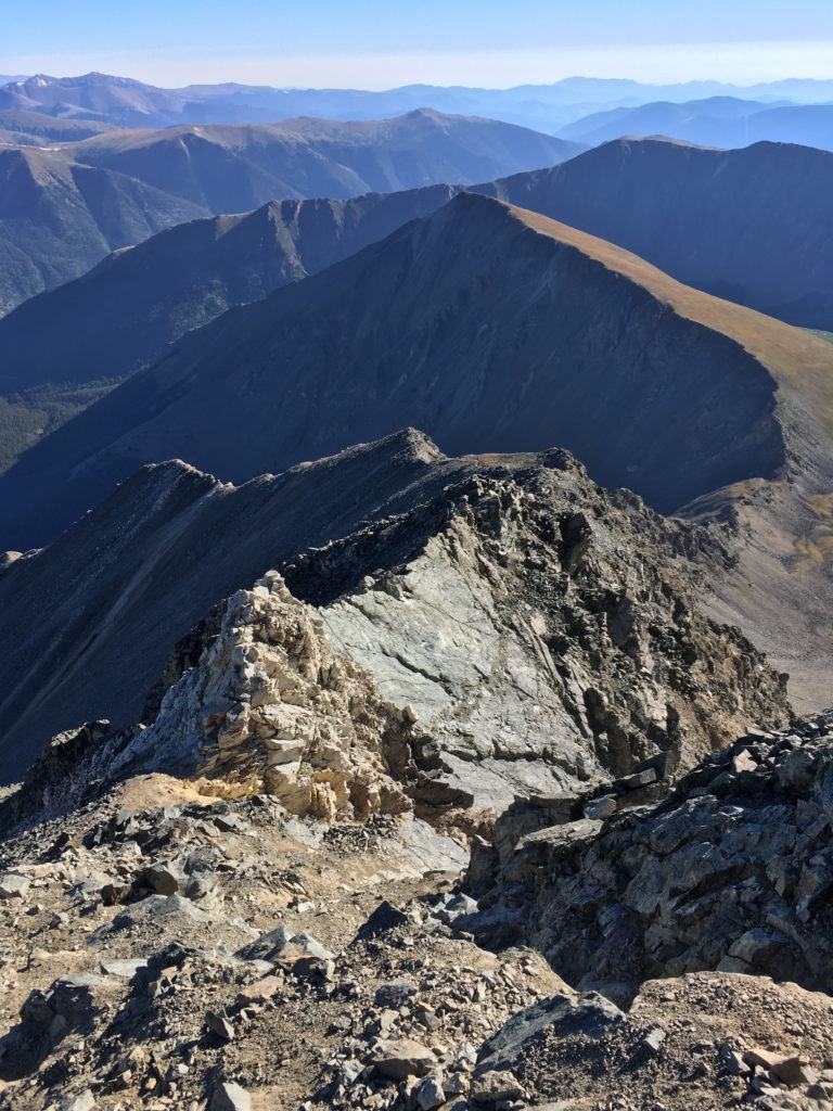
- Route: Loop
- Distance: 7.0 miles
- Elevation gain: 3,500 feet
- Difficulty: Very Hard
Everyone knows about Grays and Torreys—they’re two of the most famous (and popular) 14’ers to hike in the state. That’s mostly due to their ease and relative closeness to Denver and the Front Range. However, if you want to transform this traditional hike into a heart-pounding climb (with a bit more solitude), consider taking the Kelso Ridge Trail.
The Kelso Ridge is a technical scramble along the ridgeline. It’s mostly good rock, but there’s a ton of exposure and loose rocks at times. Along the way, you’ll encounter several sections that require careful hand-and-foot scrambling, adding an extra element of adventure to the hike.
It’s rated as a Class 3 climb. You’ll need to be comfortable with exposure and route-finding. Plus, you’ll need to make sure you’ve got a good weather window because it’s not easy to make a retreat down the ridge.
You’ll take the Kelso Ridge ascent up to Torreys Peak and then descend along the traditional hiking trail back to the parking lot. Oh, and go bag Grays while you’re up there, too. It’ll add a bit of elevation to your trip, but it’s totally worth it.
The Kelso Ridge Trail is not recommended for inexperienced hikers or those uncomfortable with exposure. It is essential to be adequately prepared with appropriate gear, including a helmet, sturdy footwear, and navigation tools.
9. Greyrock Mountain Trail, Poudre Canyon
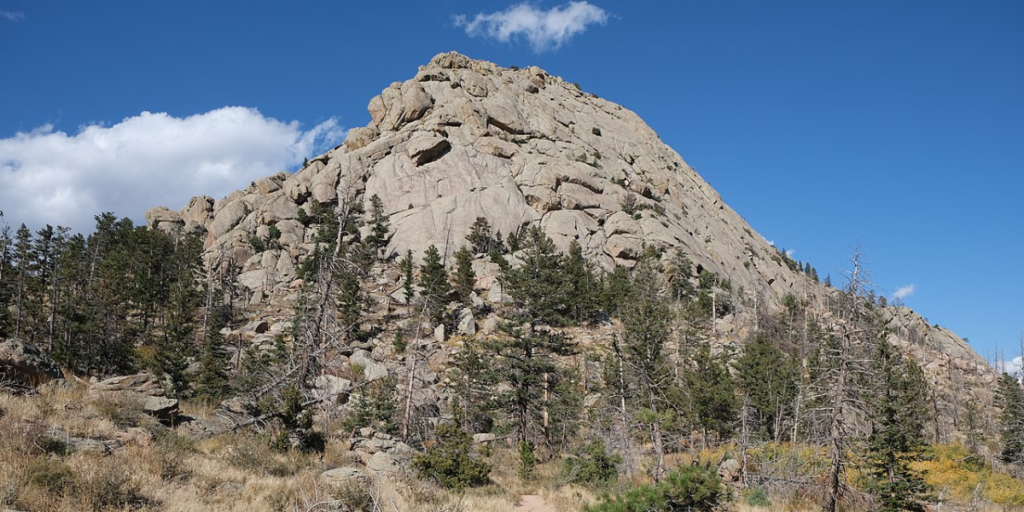
- Route: Loop
- Distance: 7.2 miles
- Elevation gain: 2,400 feet
- Difficulty: Moderate
The Greyrock Mountain Trail in Poudre Canyon offers a rewarding hiking experience through diverse terrain and stunning views. This loop takes you to the summit of Greyrock Mountain, where you can enjoy panoramic vistas of the surrounding Poudre River Valley.
The trailhead starts at the Greyrock Meadows Parking Lot, and from the beginning, you’ll traverse through a peaceful forest of ponderosa pines and Douglas firs. The trail gradually steepens as you approach the base of Greyrock Mountain. At this point, you’ll start your ascent to the summit, which involves scrambling over rocks and boulders.
It’s nothing technical, but it’s not quite a trail anymore, either. If you want to bag the true summit, you’ll need to do a bit more scrambling, but the views from the top are well worth the final push.
Plus, there’s a super-cool lake on top of Greyrock Mountain. It was completely unexpected (and much deeper than you’d think), and it makes for a cool, relaxing place to rest before the descent.
After enjoying the summit, descend via the same route or opt for the slightly longer loop by following the Greyrock Meadows Trail on the way back. The loop offers a change of scenery and the chance to explore different sections of the mountain.
10. The Spearhead, Rocky Mountain National Park
- Route: Out-and-back
- Distance: 12.5 miles
- Elevation gain: 3,500 feet
- Difficulty: Very Hard
The Spearhead is a marvel hiding deep within the basins of Rocky Mountain National Park. Casual hikers never go far enough to experience this sight, which gives it a bit more solitude, especially once you pass Mills Lake and Black Lake.
The lakes themselves are incredible, and you’ll get to see plenty on your hike. As you ascend into Glacier Gorge, the Spearhead rises out of the middle of the basin, stretching into the sky. There are plenty of exciting, technical routes on the north faces of the peak, but there’s a class 2-3 ascent if you circle around the west side of the mountain.
With careful route-finding, you can keep this hike pretty simple, though you’ll need to summon more-than-enough courage if you want to scramble up the airy ledge to tag the true summit.
11. Mount Guyot, Breckenridge
- Route: Out-and-back
- Distance: 7.8 miles
- Elevation gain: 3,000 feet
- Difficulty: Moderate
Mt. Guyot is a Class 2 hike up the northwest ridge. Breckenridge and the surrounding towns get crazy in the summer, and an escape up this mountain may just give you some of the quiet and respite you’ve been wanting.
The diverse landscapes, from peaceful forests to alpine tundra, combined with the stunning summit views, make for a great day out on the peaks. This mountain is a ranked 13’er and worth every upward step.
12. Sourdough Trail, Nederland
- Route: Out-and-back
- Distance: 11.0 miles
- Elevation gain: 1,600 feet
- Difficulty: Moderate
The Sourdough Trail near Nederland is an excellent choice for those seeking a relaxed and scenic hike in the Indian Peaks Wilderness. The trailhead starts near the town of Nederland, and from the beginning, you’ll be surrounded by dense pine forests and the soothing sounds of nature.
It’s far less crowded than nearby Brainard Lake, so you’ll get plenty of opportunities to hear the rushing water, trickling waterfalls, and chirping birds—you might even spot a moose.
The trail is relatively gentle, with minimal elevation gain/loss, making it suitable for hikers of various skill levels and ages. Turn around whenever you feel like it, or you can make it all the way to the entry station for Brainard Lake before making your way back.
With easy road access, you can also make this a point-to-point journey.
13. Engineer Mountain, Durango
- Route: Out-and-back
- Distance: 6.1 miles
- Elevation gain: 2,300 feet
- Difficulty: Hard
Engineer Mountain is one of the most prominent peaks in the San Juan Mountains, especially as you’re driving Highway 550 between Silverton and Durango. It looms above the road, begging to be climbed.
Fortunately, it’s a scenic trip to the top.
I recommend climbing Engineer Mountain from Coal Bank Pass and following the northeast ridge to the summit. It’s rated as a Class 3 climb for the short bit of scrambling you’ll need to do near the top, but don’t attempt this if climbing and exposure aren’t your cup of Tailwind. Optionally, you could always make it the crux of the climb and turn around from there—the views from this point alone are stunning enough.
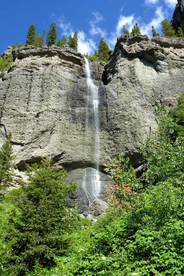
14. Fourmile Falls Trail, Pagosa Springs
- Route: Out-and-back
- Distance: 6.2 miles
- Elevation gain: 1,100 feet
- Difficulty: Easy
Fourmile Falls is one of the most popular trails in the Pagosa Springs area, but most of the tourists visiting town don’t wake up early to start their hikes—meaning you can have the falls to yourself if you’re willing to sacrifice a bit of beauty sleep.
You’ll cross beautiful, expansive meadows and stream crossings as you make your way up a relatively easy grade. Fourmile Falls itself is a cascading waterfall that roars down the cliffsides before plunging powerfully below. At the end, you can do a bit of scrambling to get better views of the second set of falls, but that’s your own build-your-own adventure.
15. Mount Zirkel Loop Trail, Steamboat Springs
- Route: Loop
- Distance: 10.6 miles
- Elevation gain: 2,400 feet
- Difficulty: Moderate
The Mount Zirkel Loop Trail (Zirkel Circle) provides an unforgettable hiking experience in the heart of the Mount Zirkel Wilderness. You get to climb high-altitude passes, visit high alpine lakes, and cross tarns on this adventure—what’s not to like?
The loop includes Gilpin Lake, Gold Creek Lake, and plenty of passes with incredible views of the surrounding peaks, including Mount Zirkel (at 12,180 feet). It’s a remote section of wilderness that gives you all the Rocky Mountain high vibes.
16. Cathedral Lake, Aspen
- Route: Out-and-back
- Distance: 5.5 miles
- Elevation gain: 2,000 feet
- Difficulty: Moderate
Cathedral Lake near Aspen is a stunning alpine lake nestled in the majestic Elk Mountains. This relatively short out-and-back trail takes you through scenic forests, rocky slopes, and meadows, rewarding you with the prize of Cathedral Lake at the end.
It’s a steep hike—no doubt about it. The end gets a bit steeper, but endure to the top. The views of Cathedral Lake and the surrounding wilderness makes it worth it. Cathedral Lake is a true gem of the alpine world, encircled by towering granite peaks and dramatic crags.
To the west, Cathedral Peak commands the skyline, its majestic presence casting a spell over the serene waters below. To the south, the ridge is anchored by the formidable Malamute Peak. And if you cast your gaze to the northwest, you’ll spot the trail to Electric Pass, carving its way through a stark talus ridge just left of the striking Leahy Peak.
17. Conundrum Hot Springs, Aspen
- Route: Out-and-back
- Distance: 16.9 miles
- Elevation gain: 2,800 feet
- Difficulty: Hard
The Conundrum Creek Trails carries you on a long hike through White River National Forest, but it rewards you with a soak in natural thermal hot pools at the end. This hike is best experienced as a backpacking adventure, giving you plenty of time to rest, relax, and enjoy the scenery before making your way back down the trail.
The trail gradually gains elevation as you make your way through dense forests, offering occasional glimpses of mountain vistas. It starts to open up as you approach the springs, providing great views of the valley and surrounding peaks.
18. Crag Crest National Recreation Trail, Grand Mesa
- Route: Loop
- Distance: 10.3 miles
- Elevation gain: 1,500 feet
- Difficulty: Easy
The Crag Crest Trail is a spectacular hike atop the spine of Colorado’s Grand Mesa, near Grand Junction. Grand Mesa, spanning 350,000 acres, is known as the world’s largest flat-topped mountain. With its diverse landscape of lakes, forests, and trails, it attracts anglers, hikers, and mountain bikers alike.
The trail, designated as a National Recreation Trail, is a 10-mile loop located near the southern end of the Grand Mesa. You have the option to hike the entire loop or choose the upper or lower sections for a shorter out-and-back hike. The upper section is for foot and equestrian traffic only, while the lower section permits mountain biking, although it is less frequented by cyclists.
The west trailhead is near mile marker 27, and the east trailhead is located at the Crag Crest Campground, accessible via FS Road 121 (Trickle Park Road). Additionally, there are short side trails that connect the lower section with the Grand Mesa Visitor Center and the nearby Ward Lake and Cobbett Lake Campgrounds, providing a third entry point to the trail.
19. Fancy Pass Trail, Red Cliff
- Route: Out-and-back
- Distance: 6.6 miles
- Elevation gain: 2,400 feet
- Difficulty: Moderate
Starting from the Fancy Creek trailhead, the trail begins its ascent with a series of moderate to steep switchbacks, guiding you through a forested hillside.
You’ll follow a creek, cross bridges, and traverse alpine meadows as you make your way to the treeline. You’ll eventually reach Fancy Lake, a beautiful pool encircled by granite peaks and crags. But your adventure doesn’t stop there—you still have a bit more to go before you reach the pass.
From the top, you can spot old mining ruins, Cross Creek Valley, Blodgett Lake, Treasure Vault Lake, and more.
20. Hope Lake, Ophir
- Route: Out-and-back
- Distance: 6.0 miles
- Elevation gain: 1,500 feet
- Difficulty: Moderate
Hope Lake is a brilliant and remote alpine lake south of Ophir in the Uncompahgre National Forest. The hike flies by quickly, with stunning views of the valley behind you and tall peaks on either side of the trail.
Eventually, you’ll reach the treeline before hiking a short way over to Hope Lake. It’s a quiet, tranquil alpine oasis with beautiful, vibrant water that reflects the colorful peaks around it.
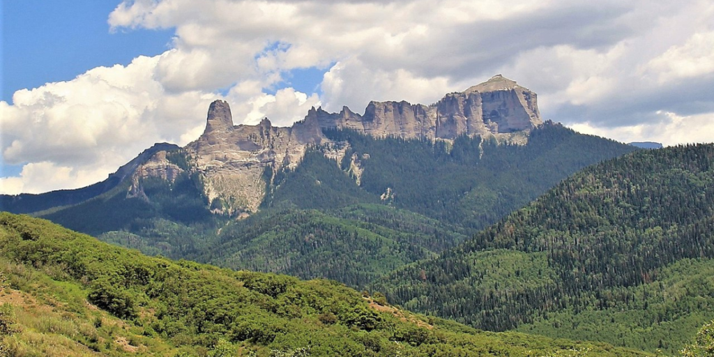
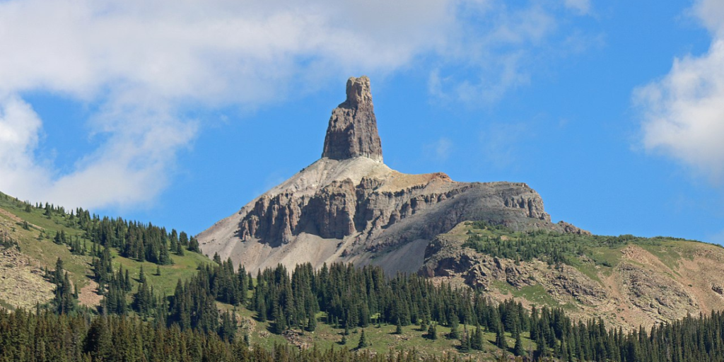
21. Courthouse Mountain, Ridgway
- Route: Out-and-back
- Distance: 3.7 miles
- Elevation gain: 1,700 feet
- Difficulty: Moderate
Courthouse Mountain and its companion Chimney Rock dominate the eastern skyline as you drive between Montrose and Ridgway and Ridgway to Ouray. It’s a bit of a drive up Owl Creek Pass to the trailhead, but it’s absolutely beautiful, especially in the changing colors of fall.
You can make your way up Courthouse Mountain from a couple of different directions, but the easiest (and shortest) path is from a trail along West Fork. It’s steep going right from the get-go, but knowing the journey is short will give you the endurance you need to make the summit in no time.
You’ll start in thick forests, but you’ll get glimpses of Courthouse Mountain and the incredible peaks to the east as you make your way up the ridge. The last push to the summit is along a carved-out trail and tundra. It’s tough going up, and the coming down is sometimes easier done on your butt.
Just saying.
22. Upper Westside to Crested Butte, Crested Butte
- Route: Lollypop
- Distance: 10.6 miles
- Elevation gain: 2,700 feet
- Difficulty: Hard
Upper Westside to Crested Butte offers a great tour of Crested Butte Mountain. You’ll get to see plenty of trails on the northwest side of the peak, and you can choose your own adventure up or down.
It’s a fun little scramble to tag the true peak, and you’ll get brilliant panoramic views of Crested Butte and Gunnison National Forest.
23. Hahns Peak Trail, Steamboat Springs
- Route: Out-and-back
- Distance: 3.6 miles
- Elevation gain: 1,400 feet
- Difficulty: Moderate
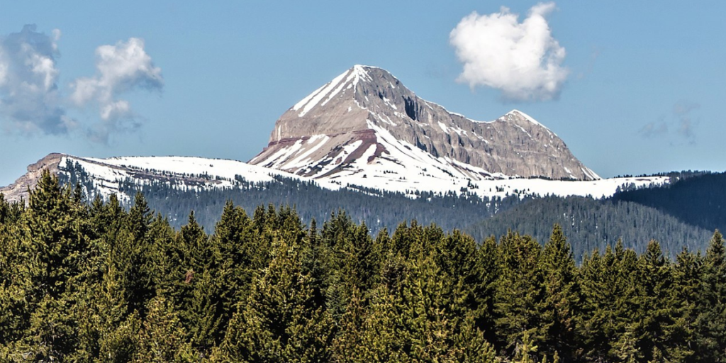
Hahns Peak is a local’s favorite in Steamboat Springs, and there’s a good reason why. Hahns Peak may not claim the title of Colorado’s tallest peak, but it possesses an undeniable allure. Rising proudly above the surrounding landscape, this volcanic mountain stands as a rocky sentinel, its bald summit visible from miles away.
24. Rainbow Trail, Salida
- Route: Point to point
- Distance: 105.0 miles
- Elevation gain: A lot
- Difficulty: Hard
Rainbow Trail provides a long trek that stretches from Silver Creek all the way to the east side of the Sangre de Cristo Mountain Range. You can do the whole trail as a point-to-point journey, or you can choose a milestone along the way and turn back for a shorter out-and-back option—it’s up to you.
There are plenty of spur trails for you to jump off to a nearby road or trailhead, and there are also many opportunities to bag the impressive peaks along your journey.
That’s what makes this trail so much fun—you can turn it into anything you want. You can make this a week-long backpacking trip (or longer), stopping wherever you like and bagging peaks along the way.
25. Mount Ouray, Salida
- Route: Out-and-back
- Distance: 6.3 miles
- Elevation gain: 3,200 feet
- Difficulty: Hard
With almost 1,000 feet of elevation gain per mile, you’re looking at a steep hike to climb this mountain. Don’t let that deter you, though. Mount Ouray is one of the 100 tallest peaks in Colorado (a centennial), but it’s remote and obscure enough that it sees hardly any foot traffic.
You might have the whole peak to yourself when you choose to do your hike. The diverse landscapes, from forests to alpine meadows and exposed ridges, combined with the rewarding summit experience, make for an extraordinary journey.
26. Lizard Head Trail, Ophir
- Route: Out-and-back
- Distance: 18.4 miles
- Elevation gain: 5,500 feet
- Difficulty: Hard
Embarking on the Lizard Head Trail, you’ll find yourself immersed in the untamed beauty of forests and meadows. As you tread through nature’s embrace, the trail gradually unveils the mountainous terrain that encircles the legendary Lizard Head Wilderness Area.
It’s not a technically challenging hike, but it’s long and has plenty of elevation. Fortunately, the views of Lizard Head and the surrounding peaks will give you the motivation you need to make it to the finish.
27. Grizzly Peak, Dillon
- Route: Out-and-back
- Distance: 5.0 miles
- Elevation gain: 1,700 feet
- Difficulty: Moderate
You can make quick work of Grizzly Peak by starting from Loveland Pass. It’s a steep hike from the get-go that levels out along the ridge for a bit before dipping down and climbing back up Grizzly Peak. You can bag Cupid and Sniktau while you’re there (it’s worth it), but Grizzly Peak is the most fun (and challenging) of the 3.
Want More of the Best Hikes in Colorado?
You’ll notice that I didn’t mention many Front Range hikes—that’s because they’re typically busy. It’s close to the airport and the state’s major cities, so that’s where tourists and locals tend to venture.
They’re good trails—don’t get me wrong. They’re just crowded, and you’ll be lucky to find a parking spot after 9am on a Saturday.
Want to discover more of the best hikes in Colorado? What about the best mountain biking destinations? We’ve got you covered. Check out all our trail recommendations from Colorado locals. Or start with the best winter hikes in Colorado.