Looking for the best hikes in Durango? We’ve got good and bad news.
The Good: You can find dozens of breathtaking hikes in and around Durango, ranging from epic peakbagging to waterfalls adventures.
The Bad (but not really that bad): It’d take a long time to see all the amazing trails that Durango has to offer.
Fortunately, we’ve got you covered. Whether you’re short on time or just looking to start with the best-of-the-best, we’re covering the most jaw-dropping hikes in Durango (and the surrounding area).
We’ll give you all the deets you need to get out, have a good time, and return safely.
Know Before You Hike in Durango
New to hiking in Durango? While you might think it’s similar to hiking in any other place, there are a few nuances you should be aware of before stepping on the trail:
- Altitude Awareness: Durango sits at an elevation of about 6,500 feet, and many trails ascend even higher. It’s essential to be aware of altitude sickness and its symptoms. Drink plenty of water, ascend slowly, and consider spending a day or two in town to acclimatize before tackling higher elevations.
- Weather Watch: Mountain weather can be unpredictable. Afternoon thunderstorms are common in the summer, so it’s best to start hikes early in the day. Always check the weather forecast and be prepared for sudden changes.
- Wildlife Wisdom: Durango is home to a variety of wildlife, including bears, mountain lions, and elk. Know how to store food properly, make noise while hiking, and what to do if you encounter wildlife. People have died (yes, died) hiking in and around Durango, so be careful and know your stuff.
- Respect Private Property: Some trails may pass through or near private lands. Always respect property boundaries and signs.
- Stay Connected: While many trails might have limited cell service, inform someone of your hiking plans and expected return time. Consider carrying a whistle or personal locator beacon for emergencies.
- Local Insights: Don’t hesitate to chat with locals (me!) or visit local outdoor shops. They often have the best recommendations and can provide insights on lesser-known trails and current conditions.
Best Hikes in the Durango Area
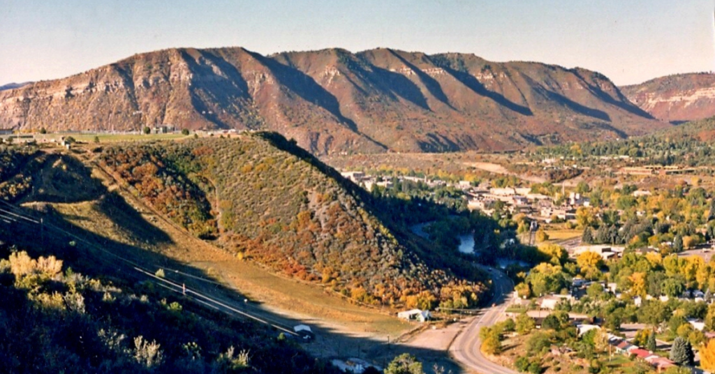
Durango is a haven for outdoor enthusiasts and nature lovers alike. But beyond its historic downtown and the chug of the Durango & Silverton Narrow Gauge Railroad lies a treasure trove of trails that beckon hikers of all levels.
And who better to guide you through these hidden gems than a local? I live in Ouray, Colorado, so you consider Durango my slightly extended backyard. Dive into this list of jaw-dropping hikes in Durango, handpicked by those who know the land best, and discover the charm that awaits outside your door.
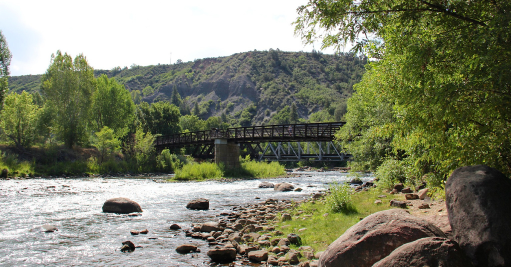
1. Animas River Trail
- Distance: Approximately 7 miles one way.
- Elevation Gain: Minimal, as it’s mostly a flat trail.
- Difficulty: Easy.
Winding alongside the Animas River, this paved trail provides hikers and joggers with fantastic views of the city’s surrounding peaks.
What sets the Animas River Trail apart is its accessibility. You can hop on this trail straight from historic downtown Durango and meander your way south along the river, stopping at interpretive signs along the way.
2. Lake Nighthorse Trail
- Distance: Approximately 4-5 miles round trip (depending on the chosen loop or path).
- Elevation Gain: Minimal, as it’s mostly a flat trail around the lake.
- Difficulty: Easy to Moderate.
Lake Nighthorse Trail is a well-maintained path that circles Lake Nighthorse, located a few miles from downtown Durango. The trail is primarily flat, making it suitable for hikers of all levels, including families and joggers.
As you walk, you’ll have clear views of the lake and the surrounding mountains. The trail provides multiple access points for fishing and has several picnic spots. It’s a popular spot for both locals and visitors looking for a straightforward hike with scenic views.
3. Smelter Mountain Trail
- Distance: Approximately 3 miles round trip.
- Elevation Gain: About 1,300 feet.
- Difficulty: Moderate.
Smelter Mountain Trail is a short but steep hike located close to Durango. The trail takes hikers up Smelter Mountain, offering clear views of Durango, the Animas River, and the surrounding region. The path is well-defined, but the incline can be challenging, especially for those not used to the elevation and altitude.
At the summit, there’s a viewpoint that serves as a popular spot for both locals and visitors to get a bird’s-eye view of the area. Parking is available at the trailhead, but it can get crowded during peak times.
4. Colorado Trail
- Starting Point: The southern terminus of the Colorado Trail is located at the Junction Creek Trailhead in Durango.
- Distance: Approximately 21 miles from Junction Creek Trailhead to Kennebec Trailhead (the end of Segment 28).
- Elevation Gain: The segment starts at around 6,900 feet and climbs to over 10,500 feet, so expect a significant elevation gain.
- Difficulty: Moderate to Difficult due to the elevation gain and distance.
Technically, you could follow the Colorado Trail from Durango all the way to Denver, but that’s probably not what you had in mind when looking for hiking trails in Durango.
Segment 28 of the Colorado Trail, starting from the Junction Creek Trailhead in Durango, offers hikers a taste of the diverse landscapes and challenges the trail is known for. The trail winds through dense forests, crosses streams, and gradually ascends into the high alpine environment. As you climb, you’ll be treated to panoramic views of the surrounding San Juan Mountains.
For those looking for a day hike, a popular option is to hike up to Gudy’s Rest, which is about 5 miles from the Junction Creek Trailhead. This spot offers a scenic overlook and is a good turnaround point for a 10-mile round-trip hike. The trail up to Gudy’s Rest is moderately steep, so be prepared for a workout.
5. Twin Buttes Trail
- Distance: Approximately 7-8 miles round trip, depending on the chosen loop or path.
- Elevation Gain: About 1,300 feet.
- Difficulty: Moderate.
The trail takes hikers up to the Twin Buttes, two prominent landmarks visible from various parts of Durango. The path is well-defined, with some steep sections, especially as you approach the buttes. From the summit, hikers get clear views of Durango, the Animas Valley, and the surrounding mountain ranges.
There are several loop options and off-shoot trails, allowing you to customize your own experience.
6. Goulding Creek Trail
- Distance: Approximately 6 miles round trip.
- Elevation Gain: About 2,200 feet.
- Difficulty: Moderate to Difficult.
Goulding Creek Trail is located north of Durango and offers a moderately challenging hike through dense forests and open meadows. The trail steadily ascends, taking hikers through a mix of terrains, including dense pine forests, aspen groves, and open meadows.
The trail culminates at a high point that offers panoramic views of the region, making the climb worthwhile. Due to its elevation and exposure, it’s essential to be prepared for changing weather conditions, especially during the shoulder seasons.
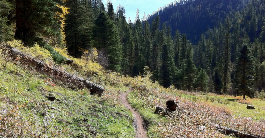
7. Hermosa Creek Trail
- Distance: Approximately 19 miles one way.
- Elevation Gain: About 2,800 feet.
- Difficulty: Moderate.
Hermosa Creek Trail is located north of Durango and is known for its scenic beauty and diverse terrain. The trail follows Hermosa Creek, winding through dense forests, open meadows, and alongside the creek itself. It offers a mix of terrains, from flat sections alongside the creek to moderate climbs through the forest.
The trail is popular not only among hikers but also mountain bikers—so keep your head up. The path provides multiple access points to the creek, making it a favorite spot for fishing and picnicking. Due to its length, some hikers choose to tackle specific sections of the trail for day hikes, while others opt for multi-day backpacking trips.
For those looking for a shorter day hike, the lower sections of the trail, closer to the trailhead, offer beautiful views of the creek and surrounding forests.
8. Animas Mountain Trail
- Distance: Approximately 6 miles round trip.
- Elevation Gain: About 1,500 feet.
- Difficulty: Moderate.
The Animas Mountain Trail is a popular loop trail located in Durango. The trail offers a steady climb up Animas Mountain—it’s well-defined and has plenty of switchbacks to make the ascent a bit more manageable. God bless you, switchbacks.
As you climb, you’ll traverse through juniper and pinon pine forests. The trail’s higher sections offer clear vantage points, making it a favorite spot for sunrise or sunset hikes. The loop design allows hikers to experience different views on the ascent and descent.
Due to its proximity to Durango, the trail is popular among locals and can get busy during weekends. Parking is available at the trailhead, but it can fill up quickly during peak times. Show up early if you want a spot.
9. Haflin Creek Trail
- Distance: Approximately 8 miles round trip.
- Elevation Gain: About 3,200 feet.
- Difficulty: Difficult.
Haflin Creek Trail is a challenging hike located near Durango. The trail offers a steady and, at times, steep ascent through dense forests, leading to open meadows and ridgelines. As you climb, you’ll be treated to increasingly expansive views of the Animas Valley and the surrounding San Juan Mountains.
The trail is well-marked but can be demanding due to its elevation gain and rugged terrain. The higher sections of the trail provide clear vantage points, making it a rewarding hike for those who reach the top. The trail culminates at a high point that offers panoramic views of the region.
10. Perins Peak
- Distance: Approximately 4-5 miles round trip.
- Elevation Gain: About 1,500 feet.
- Difficulty: Moderate.
You can find a few different ways to make your way up Perins Peak, but the most popular (and standard) route is from the north from Tanglewood Drive. There’s another option from Hogsback, but it’s more challenging.
Perins Peak Trail is a moderately challenging hike located near Durango. The trail takes hikers up to the summit of Perins Peak, a prominent landmark visible from various parts of Durango. The path is well-defined and consists of switchbacks that navigate through dense forests and open meadows.
11. Lions Den Trail
- Distance: Approximately 1.5 miles round trip.
- Elevation Gain: About 500 feet.
- Difficulty: Moderate.
The trail offers a quick ascent to a viewpoint overlooking Durango and the Animas River. The path is well-defined, and while it’s relatively short, the incline can be challenging, especially for those not used to elevation.
The viewpoint at the top, known as the “Lion’s Den,” provides panoramic views of the surrounding area, making it a popular spot for both locals and visitors. The trail is commonly used for hiking and nature trips, and due to its short distance, it’s a favorite among those looking for a quick hike with rewarding views.
12. Raiders Ridge Lookout
- Distance: Approximately 3-4 miles round trip.
- Elevation Gain: About 800 feet.
- Difficulty: Moderate.
The trail takes hikers up to a ridge that offers expansive views of Durango, the Animas Valley, and the surrounding mountain ranges. It’s a well-defined trail that offers a suprising amount of shade, making it perfect for a late morning or early afternoon hike.
The lookout offers plenty of awesome views of the surrounding area, and you can branch off to other trails and loops to extend your hike if you choose.
Go Hike Durango and Beyond
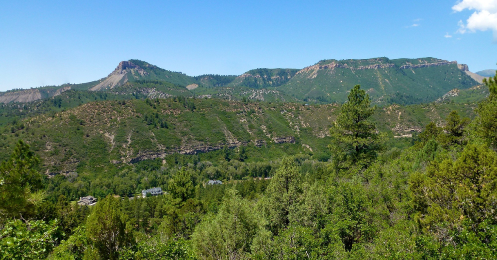
Durango, with its majestic mountains, serene valleys, and diverse trails, is a hiker’s paradise. Whether you’re a seasoned trekker seeking a challenging ascent or a casual hiker looking for a leisurely stroll, Durango and its surrounding areas offer something for everyone.
Each trail, from the iconic Colorado Trail to the panoramic views from Raiders Ridge Lookout, shows a unique angle of the nearby mountains and valleys, exploring the region’s rich history.
What are you waiting for? Lace up your shoes, get out your map, and explore some of Durango’s best hiking trails.