Great Sand Dunes National Park is one of Colorado’s hidden gems (despite its recognition as a national park). The park only receives around half a million visitors annually—that’s about 10% of what Rocky Mountain National Park sees each year.
While the Great Sand Dunes are lovely to look at, most people dismiss the park because “it doesn’t have much to do.” That couldn’t be further from the truth.
From the best hikes in Great Sand Dunes National Park to sandboarding to 4WD offroading adventures, there’s a bit of something for everyone in this underrated outdoor mecca.
These are the tallest dunes in North America for crying out loud. And they’re nestled between massive peaks, wetlands, alpine lakes, and grasslands—what more could you ask for?
If you’re looking to lace up your shoes and explore the local trails, we’ve got what you need. Below, we’ll walk you through the 11 best hikes in Great Sand Dunes National Park—from short out-and-back trips to all-day outings.
First, finding the park might be helpful.
Where Is Great Sand Dunes National Park?
Great Sand Dunes National Park is located in southern Colorado in Saguache and Alamosa Counties. It’s not very close to any major roads, which lends itself to the seclusion you can find on these dunes and local trails. The park spreads across 150,000 acres from the western base of the Sangre de Cristo Mountains eastward (about 25 miles northeast of Alamosa).
Now, let’s get to the fun stuff—all the great hikes in Great Sand Dunes National Park.
Great Sand Dunes National Parks Trail Map
Here’s a quick map of all the best destinations in Great Sand Dunes National Park.
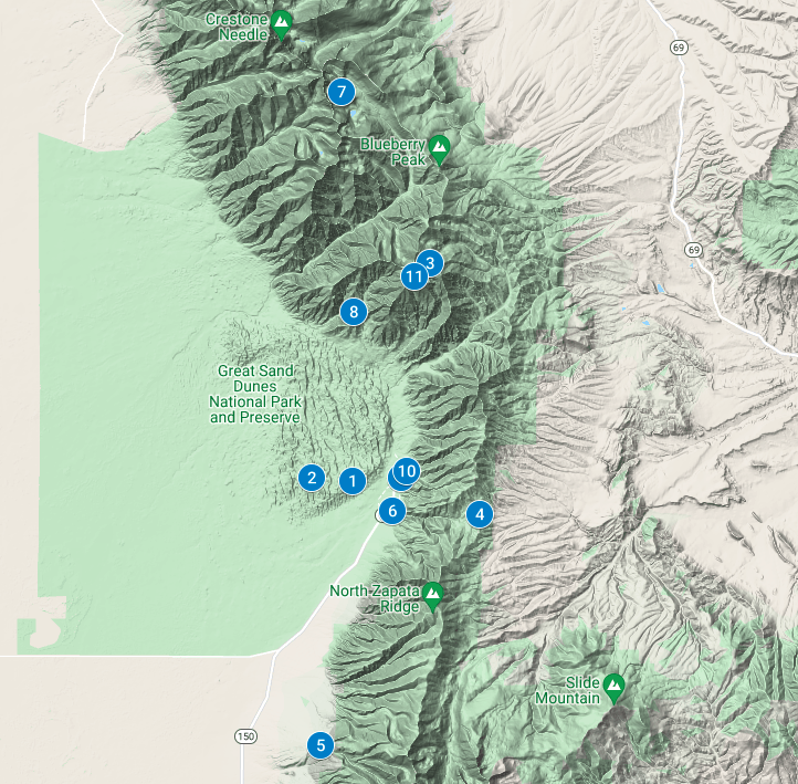
11 Hikes in Great Sand Dunes National Park
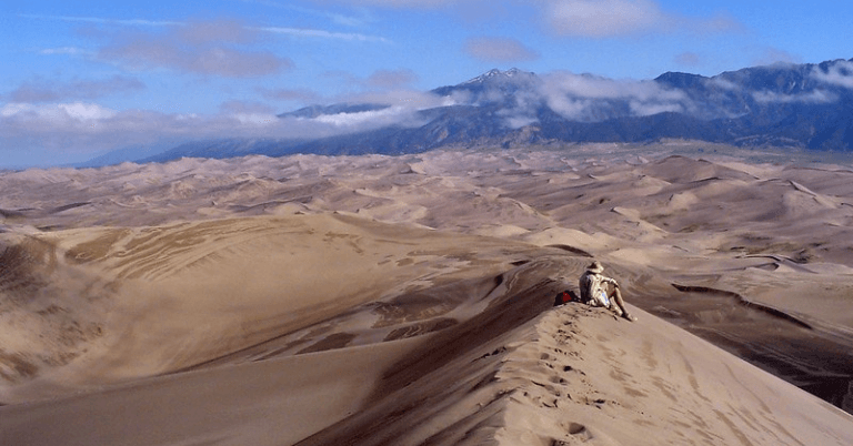
1. High Dune Trail
Distance: 3.0 Miles
Elevation Gain: ~600 Feet
Difficulty: Hard
Type: Out-and-Back
The High Dune Trail is the top-rated hike in Great Sand Dunes National Park, but it’s best enjoyed when approached with the right expectations.
First, there’s no official trail.
That’s right. To enjoy this peak and vantage point, you’ll have to make your own path over the steep dunes and deep sand. Bring a map (or make sure you have a GPS app on your phone installed) to help you find the right peak and take the path of least resistance.
600 feet of elevation gain might sound like a cakewalk, but don’t forget—it’s on loose sand. It’s a bit harder than you think. Take extra food and water—this isn’t an hour-long out-and-back.
Despite High Dune’s prominence, it’s actually not the tallest summit in the park. Nope. To get that, you’ll have to scroll down to the next hike: Star Dune Trail.
2. Star Dune Trail

Distance: 7.3 Miles
Elevation Gain: ~1,000 Feet
Difficulty: Moderate
Type: Out-and-Back (or Loop With High Dune)
Star Dune and Hidden Dune (also tucked quietly away in the park) are tied as the 2 tallest dunes in North America at 741 feet—though it’s a more committing outing to go and claim Hidden Dune’s summit.
Star Dune and High Dune make for a great combo outing, but Star Dune alone is worth the sand-filled trek. You can find a more direct access route to the summit from the base along Medano Creek.
Again, there is no trail.
This outing is more than twice the distance as High Dune, so be prepared with extra food and water. Also, leave early enough in the morning that you don’t get stuck with blazing hot sand after the sun’s been up.
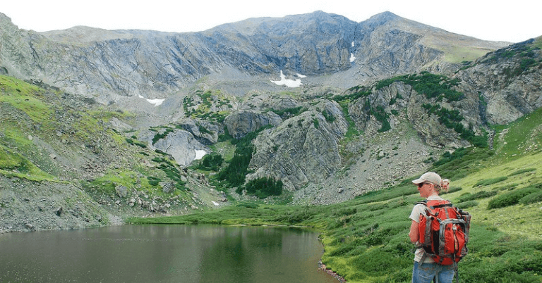
3. Medano Lake Trail
Distance: 8.0 Miles
Elevation Gain: ~2,300 Feet
Difficulty: Moderate
Type: Out-and-Back
The Medano Lake Trail starts from Medano Pass 4WD road at a hearty 10,000 feet. You’ll climb an additional 2,000 feet through dense forests to reach the alpine lake.
You’ll encounter a few creek crossings and groves of aspen trees along the way, making for a cool, comfortable hike. While it’s nearly 2,300 feet of elevation gain to reach the lake, the trail feels relatively gradual, and you’ll feel the miles just melting away.
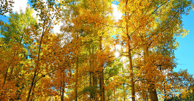
4. Mosca Pass Trail
Distance: 6.5 Miles
Elevation Gain: ~1,500 Feet
Difficulty: Moderate
Type: Out-and-Back
Get out of the sun and into the trees with the Mosca Pass forested trail. You’ll walk alongside a creek through aspen and evergreen trees to get to the alpine pass in the Sangre de Cristo Mountains.
Enjoy the experience because that’s what this trail is all about. You’ll get decent views from the top, but the best moments are the ones spent meandering through the forest.
5. Zapata Falls Trail
Distance: 1 Mile
Elevation Gain: ~200 Feet
Difficulty: Easy
Type: Out-and-Back
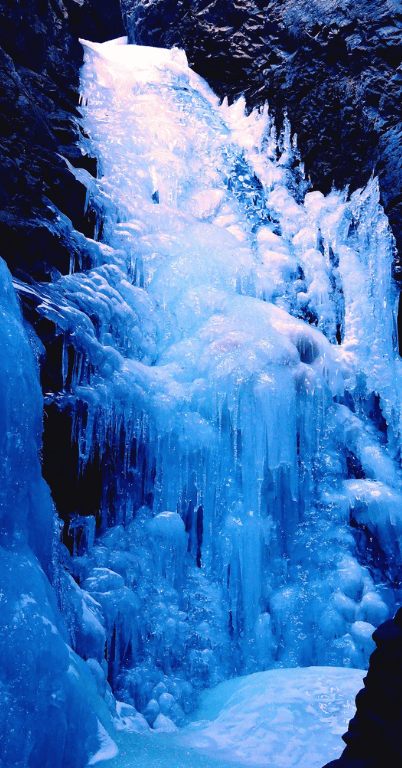
Want a chill, leisurely day on the trails? Drive about 30 minutes south of the national park, and take a short hike up to Zapata Falls. The path is only about a mile long, with some fun rock-hopping to reach the base of the waterfall.
While this is a great summertime hike for families, it’s also a good winter adventure if you want to see the frozen falls. Bring microspikes and poles to make the experience a bit smoother.
6. Montville Nature Trail
Distance: 0.5 Miles
Elevation Gain: ~100 Feet
Difficulty: Super Easy
Type: Loop
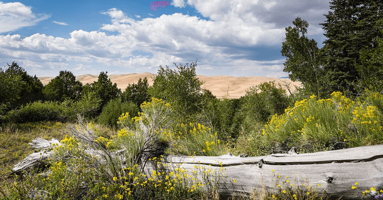
Need a short hike for the kiddos to get out and stretch their legs? The Montville Nature Trail is a quick, easy jaunt for those who don’t want to climb up the hot sand dunes.
You’ll get to see wildlife, the dunes, and the towering mountains behind them. If you like to stop and read every information sign (some people do), this hike could take you around an hour or so. It doesn’t get easier than this at Great Sand Dunes National Park.
7. Upper Sand Creek Lake Trail
Distance: 7.5 Miles
Elevation Gain: ~2,000 Feet
Difficulty: Hard
Type: Out-and-Back
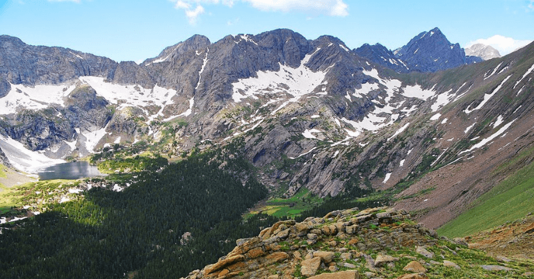
Escape the dunes and get into the mountains on the Upper Sand Creek Lake Trail. This trail takes you above treeline to a beautiful alpine lake that reflects 13,357′ nearby Music Mountain, and it’s one of the best hikes in Great Sand Dunes National Park.
There are plenty of other tiny alpine lakes nearby, so feel free to bushwack and explore all that the alpine terrain has to offer. If you’re up for an all-day epic, go ahead and summit Music Mountain—it’s a class 3 classic. The route beings on the east ridge just south of Upper Sand Creek Lake (and north of Lower Sand Creek Lake).
8. Point of No Return to Cold Creek
Distance: 18.5 Miles
Elevation Gain: ~2,500 Feet
Difficulty: Hard
Type: Out-and-Back
The Point of No Return trail is a great way to access Cold Creek, but backpacking (permit needed) makes this experience a bit more enjoyable. Multiple creek crossings give you plenty of areas to refill your water bottles, but the campsite has everything you need for a comfy night outing.
This trail isn’t for the faint of heart. It’s over 9 miles one way, and most of that is spent trekking through the sand. Hard? Yes. Worth it? Also, yes.
9. Sand Ramp Trail
Distance: 11 Miles
Elevation Gain: ?
Difficulty: Moderate
Type: Point-to-Point
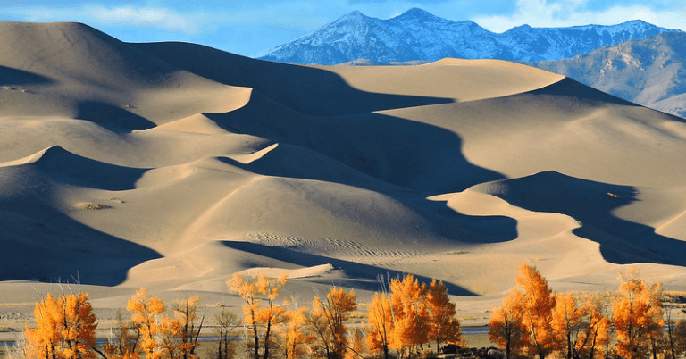
Sand Ramp Trail is one of the longest trails in the park, and it’s typically used by backpackers accessing campsites in the nearby foothills. It’s a long hike, but the route is relatively flat.
You won’t find much shade or wildlife along this trail—there’s a reason it’s called Sand Ramp. If you’re not going backpacking, maybe save this trail for another day.
10. Dunes Overlook Trail
Distance: 2.7 Miles
Elevation Gain: ~500 Feet
Difficulty: Moderate
Type: Out-and-Back
This is a relatively easy out-and-back trail with incredible views of the sand dunes and the mountainous backdrop. You’ll find a few benches along the way and at the summit, making this a more family-friendly outing.
With so many other options nearby, you might not see another person while out on this short hike—which is what makes this a true gem, especially if you visit the park on a busy weekend.
11. Mount Herard Trail
Distance: 8.8 Miles
Elevation Gain: ~3,700 Feet
Difficulty: Hard
Type: Out-and-Back
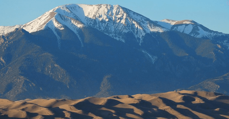
Follow the same trail you’d take to reach Medano Lake, except your journey doesn’t end at the water. No, you’ll be going up, up, up to the top of one of the area’s tallest peaks: Mount Herard.
At 13,297′, you’ll have amazing aerial views of the 30-square-mile dune fields below you. Make sure you’re acclimated because you’ll be spending a fair amount of the day at a high altitude on this hike.
Get Out and Explore Colorado
The sun and sand are waiting. Get out there and explore these hikes in Great Sand Dunes National Park—and let me know what you think.
Colorado’s hidden gems aren’t always easy to access—but they’re always worth the sweat and sore muscles. Get out and explore all that the state has to offer. Find your next adventure on Unknown Colorado.

