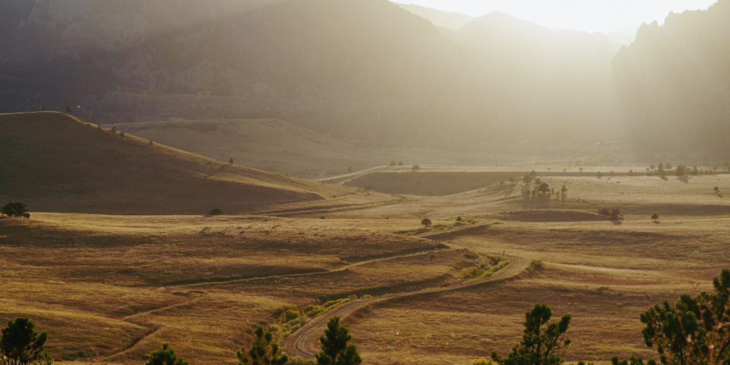
Boulder, Colorado, is a trail runner’s paradise. Whether you like cruising down technical singletrack or hands-on-your-knees ascents, running trails in Boulder have it all.
I lived in Boulder County for 4 years, enjoying all the local trails up and down the Flatirons—from winter climbs up Bear Peak to blazing-hot Mount Sanitas runs. There’s a lot to offer (if you know where to look).
Looking to discover your new favorite trail or need something to spice up your training routine? You’ve come to the right place. We want to help beginners find the perfect entry-level terrain and professionals discover hidden gems that push their limits.
Tie up your running shoes, take a big whiff of that ponderosa pine air, and get ready to make lasting memories on the most wow-inducing running trails in Boulder.
What You Need to Know About Trail Running in Boulder
Whether you are new to trail running or a seasoned pro, here are some essential things you need to know before hitting the trails in Boulder:
- Trail Variety: Boulder offers an extensive network of trails, each with its own unique features and challenges. You’ll find everything from easy, flat paths suitable for beginners to steep, technical trails that will test even the most experienced runners. Take the time to research and choose routes that align with your skill level and fitness goals.
- Altitude Awareness: Boulder sits at a high altitude, ranging from approximately 5,300 to 7,000 feet above sea level. If you’re not acclimated to the altitude, be prepared for the thinner air, which can affect your breathing and performance. Stay hydrated and listen to your body as you adjust to the elevation.
- Weather Considerations: Boulder’s weather can be unpredictable, especially in the mountains. Before heading out, check the weather forecast and be prepared for sudden changes. Dress in layers, wear moisture-wicking clothing, and pack essentials like a lightweight rain jacket, sunscreen, and a hat.
- Trail Etiquette: Boulder’s trails are popular among hikers, bikers, and runners. Practice good trail etiquette by yielding to uphill runners, announcing your presence when passing others, and staying aware of your surroundings.
- Crowds: Boulder is a go-to hiking and running destination for the entire Front Range. Expect packed trailheads and crowded paths on the weekends. Be ready to hit the trail early if you want to find a parking spot at the most touristy locations.
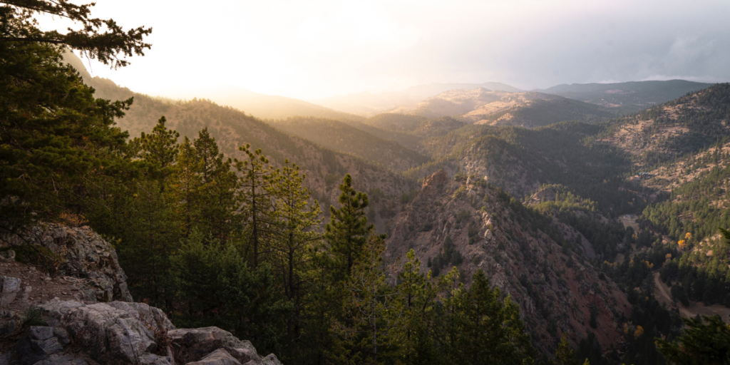
Best Running Trails in Boulder, Colorado
Consider this your tour of the best running trails in Boulder. Honestly, you could spend an entire week (or two) exploring new trails in Chautauqua Park, and you’d probably never get bored.
But there’s so much more to Boulder. There’s everything from the rolling hills of Betasso Preserve and Walker Ranch to the flatter ranch sections of Boulder Open Space and Mountain Parks.
Here, we’re exploring all the best running trails in Boulder—whether that’s bomber descents on technical, rocky singletrack or mellow long runs through fields and pastures.
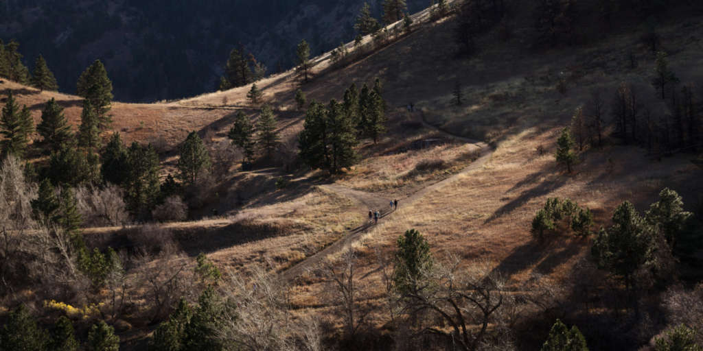
1. Mount Sanitas Loop
- Type: Loop (or out and back)
- Distance: 3.2 miles for the loop trail
- Elevation Gain: ~1,343 feet for the loop trail
- Difficulty: Moderate
The Mount Sanitas Trail is an iconic Boulder favorite that all trail runners should experience. The 3.2-mile loop can be completed in either direction, but many runners start with the East Ridge Trail for a slightly gentler ascent.
Get out on this trail earlier—it’s super popular (especially on the weekends). If you want parking, you’ll need to be bright and early. And if you want to bomb down the descents without crashing into an innocent, young family, it’s best to get started in the wee hours.
Once you reach the top, you’ll get beautiful views of Boulder, the Flatirons, and all of Boulder County. Tie those laces tight…because it’s time to fly down.
2. Anne U. White Trail
- Type: Out-and-back
- Distance: 3.2 miles
- Elevation Gain: ~500 feet
- Difficulty: Easy
The Anne U. White Trail is a super-shaded run through mellow grade, buffed-out paths, and dozens of creek crossings. You never have to get your feet wet, but the water is perfect for dipping your hat and cooling off.
This is one of the few trails in Boulder with relatively little elevation gain, making the entire trail “runnable,” even for trail running beginners. There are a few loose parts, so don’t lose your focus entirely—but enjoy the roller coaster ride through this beautiful part of the forest.
3. Canyon Loop, Betasso Preserve
- Type: Loop
- Distance: 3.3 miles
- Elevation Gain: ~500 feet
- Difficulty: Easy
The Canyon Loop at Betasso Preserve is a popular trail among runners seeking a satisfying and scenic run through the foothills of Boulder. This loop trail offers a mix of natural beauty, varying terrain, and captivating views, making it a favorite among locals and visitors.
Due to the popularity of these trails, Boulder County has a few regulations. As of July 2023, bikers aren’t allowed on Betasso trails on Wednesdays and Saturdays. Check the county’s trail page for the most up-to-date information before you go.
Also, the trails have shifted to become directional, and the direction shifts from time to time. Follow the signs to avoid a head-on collision with a rowdy mountain biker.
4. Benjamin Loop, Betasso Preserve
- Type: Loop
- Distance: 3.9 miles
- Elevation Gain: ~650 feet
- Difficulty: Moderate
Once you’re about halfway through the Canyon Loop, you can take a short connecting trail over to the Benjamin Loop.
The Benjamin Loop feels a bit more forested, so the views aren’t quite as good—but the trail is narrow and bomber on the clockwise descent, making for a rowdy and technically challenging downhill run.
5. Royal Arch Trail
- Type: Out-and-back
- Distance: 3.4 miles
- Elevation Gain: ~1,500 feet
- Difficulty: Hard
The Royal Arch Trail is a captivating and challenging trail located in the iconic Chautauqua Park. It is one of the most sought-after trails in the area, renowned for its striking natural rock arch formation known as the Royal Arch. However, you’ll have to work for it.
This trail can be super steep in sections and has plenty of stairs. You’ll probably spend a good deal of the ascent power hiking, and the downhill is a technical, fun-filled wonder.
The trail begins at the Chautauqua Trailhead, and as you ascend, you’ll be greeted with captivating views of the Flatirons and the Boulder Valley. The first section of the trail is relatively moderate, meandering through shaded forests and offering a taste of Boulder’s natural beauty.
As you progress, the trail becomes steeper. You’ll encounter a series of rock steps and switchbacks that add to the challenge of the ascent. The final stretch leads you to a rocky scramble, which can be both exhilarating and technical.
At the trail’s apex, you’ll find the Royal Arch, a stunning sandstone formation that frames breathtaking vistas of Boulder and beyond.
6. Green Mountain Loop
- Type: Loop
- Distance: 6.1 miles
- Elevation Gain: ~2,600 feet
- Difficulty: Hard
There are plenty of ways to get up and down Green Mountain, but the most iconic (and classic) route is to go up the northern Chautauqua and Amphitheater Trails and descend on the northwestern Gregory Canyon Trail.
The journey begins at the Chautauqua Trailhead in the historic Chautauqua Park. As you set foot on the trail, you’ll be immersed in the natural beauty of the Boulder foothills, surrounded by stunning rock formations known as the Flatirons. Get here early. There is limited parking, and it fills up quickly.
The ascent begins with the Chautauqua Trail, taking you through a mix of wooded areas and open meadows. This initial section is relatively moderate, allowing you to warm up and enjoy the peaceful ambiance of the park.
As you progress, you’ll connect to the Amphitheater Trail, which offers a steeper climb with several switchbacks. This part of the trail tests your endurance and rewards you with elevated views of Boulder and the Front Range.
It’s a steep trail to the top of Green Mountain, and you’ll even have to climb a few short ladders to traverse some vertical sections. The summit features an awesome rocky outcropping you can scramble to the top. You’ll have incredible views of the entire park and the surrounding trails, plus the town of Boulder and the rest of the Front Range.
The trail leads you down the northwestern Gregory Canyon Trail for the descent. This section is known for its rocky terrain, adding an element of technicality to the run. The path descends through lush forests, offering a tranquil experience after the exhilaration of the summit.
7. First and Second Flatiron Loop
- Type: Loop
- Distance: 2.7 miles
- Elevation Gain: ~1,500 feet
- Difficulty: Moderate
The trail begins at the Chautauqua Trailhead in Chautauqua Park, one of Boulder’s most popular trailheads. As you embark on the journey, you’ll be greeted by the striking rock formations of the First and Second Flatirons— colossal slabs of rock that stand proudly against the skyline.
This is your destination, so lace up those shoes nice and tight. Things are about to get steep.
The trail initially meanders through a picturesque pine forest, offering a serene start to the run. However, as you progress, the ascent becomes steep and demanding. The trail skirts around the south side of the Flatirons with incredible views of the rest of the range. Look closely, and you might just see some climbers making their way up the slabs.
Careful on the descent. A wrong step could end with a faceful of rock—nobody wants that.
8. Boulder Reservoir Loop
- Type: Loop
- Distance: 5.3 miles
- Elevation Gain: ~200 feet
- Difficulty: Easy
The trail hugs the reservoir’s shoreline, offering unobstructed views of the sparkling water and the surrounding foothills. The path is typically well-maintained and consists of packed dirt or gravel, providing a comfortable surface for running.
Throughout the loop, you’ll encounter several viewpoints, allowing you to pause and appreciate the landscape. Whether it’s the early morning light casting a golden glow over the reservoir or the captivating sunset reflecting on the water, each moment along the loop promises to be a memorable experience.
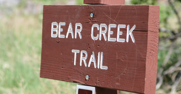
9. Bear Peak Canyon Loop
- Type: Loop
- Distance: 8.4 miles
- Elevation Gain: ~2,800 feet
- Difficulty: Hard
Bear Peak is one of the other incredible summits across the Boulder Skyline. It’s steeper than any of the other classics, but it’s oh-so rewarding. I’ve done this as a winter summit with microspikes, and it’s one of my favorite running trails in Boulder.
Granted, there’s not a whole lot of running to do on the ascent. It’s steep and rocky, and while some can conquer this grade, don’t feel defeated if you have to resort to hands-on-knees power hiking.
You’ll start at the NCAR parking lot. The loop option takes you up the south slope of the peak with a super-fun (and a bit exposed) ridge climb to the true summit (if you’re into that kind of thing). After that, you’ll take a much more gentle descent west of the peak that’ll take you through some canyons on your descent back to NCAR.
10. South Boulder Peak via Homestead Trail
- Type: Out-and-back
- Distance: 8.0 miles
- Elevation Gain: ~3,000 feet
- Difficulty: Hard
Ready to tackle another Boulder high point while getting a good trail running workout? You’ll get plenty of elevation gain on this route, and the descent will definitely keep you on your toes.
You start on the Homestead Trail on the south side of Boulder, meandering through meadows and foothills as you approach the base of your climb. Eventually, you’ll turn onto the Shadow Canyon Trail and begin your steeper ascent up the mountain.
The trail takes you through a rocky landscape, with sections of loose scree, adding an element of technicality to the run. Take a moment to enjoy the breathtaking 360-degree views from the summit. The panorama includes the Flatirons, the Boulder Valley, and distant mountain ranges.
11. South Mesa, Shadow Canyon Loop
- Type: Loop
- Distance: 6.0 miles
- Elevation Gain: ~1,100 feet
- Difficulty: Moderate
The South Mesa – Shadow Canyon Loop is a captivating and challenging trail running route in Boulder, Colorado, offering a diverse and scenic experience through canyons, meadows, and rocky terrain.
The loop begins at the South Mesa Trailhead, where you’ll start by following the South Mesa Trail. This scenic trail winds through picturesque meadows and shaded forests and offers glimpses of the towering Flatirons. Eventually, you’ll connect with a brief portion of the Shadow Canyon Trail and Bluestem before bombing back down to the trailhead.
The fun, runnable terrain is the perfect elevation to let you run up and down without blasting yourself into Zone 4 and 5.
12. Doudy Draw and Spring Brook Loop
- Type: Lollipop
- Distance: 4.9 miles
- Elevation Gain: ~600 feet
- Difficulty: Easy
Start on the Doudy Draw trail and head south through rolling hills. It’s countryside farmland perfect for warming up and getting your legs ready for the Spring Brook Loop. You’ll eventually come to a fork in the trail—stick right to continue on your route.
You can take the Spring Brook Loop in either direction, but I prefer doing this one counter-clockwise. It’s a more gradual ascent that’s pretty much all runnable, and then the rocky downhill running makes for some fun, challenging terrain.
13. Rattlesnake Gulch Loop
- Type: Loop
- Distance: 3.6 miles
- Elevation Gain: ~850 feet
- Difficulty: Moderate
Nestled in Eldorado Canyon State Park, this loop offers a scenic journey through towering cliffs, lush vegetation, and the picturesque South Boulder Creek.
The trail begins at the Rattlesnake Gulch Trailhead, where you’ll embark on your adventure into the heart of Eldorado Canyon. The Rattlesnake Gulch Trail initially winds through a lush forest, providing a serene and shaded start to your run.
Don’t forget to look up. Eldorado Canyon offers some of the most impressive cliffs, and you’ll likely see teams of climbers ascending the tall, vibrant rock formations.
One of the highlights of the loop is the historic Crags Hotel ruins, which you’ll encounter along the trail. This fascinating piece of history dates back to the early 1900s—take a moment to read the signage at the ruins and imagine the area’s heyday.
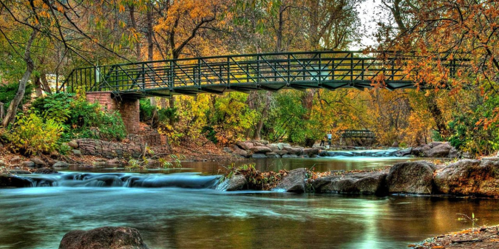
14. Walker Ranch Loop
- Type: Loop
- Distance: 8.0 miles
- Elevation Gain: ~1,600 feet
- Difficulty: Moderate
Walker Ranch is a must-experience trail running destination in Boulder. It’s a bit of a drive up and over Flagstaff Mountain to get to Walker Ranch Homestead, but the long run is worth the gas.
You can take this trail either way, but I typically take it clockwise. Eventually, you’ll encounter a long set of stairs, and I prefer to go up these rather than down (especially with a mountain bike).
The clockwise loop starts off nice and meadow with some nice rolling singletrack. After a short warmup, you’ll ditch the cliffside and dive into the trees for some steep (often washed out) terrain and switchbacks. Watch your footing and enjoy the downhill.
After a short bit, it opens up to a wide fire road full of ankle-twisting gravel and rocks. It’s still time to fly before you eventually reach the river and a bridge crossing.
Now, for the stairs.
After the stairs, you’ll climb for a few more miles before reaching your next high point, where it’s cruisy wide trails to reach the river again. One final climb out, and you’re back to the trailhead.
15. Fowler Goshawk Ridge
- Type: Loop
- Distance: 4.1 miles
- Elevation Gain: ~750 feet
- Difficulty: Moderate
The Folwer Goshawk Ridge is a great running trail just outside of Eldorado Canyon State Park. It’s been one of my go-to running trails, especially since it links up nicely with the trails in the park and also Spring Brook Loop for extra miles.
This is the way to go if you’re determined to get into the State Park and can’t find parking (or don’t want to pay the fee).
You’ll pass through some really cool rock formations on the trail, and it opens up to spectacular views of the canyon and the Flatirons to the north. The trail’s south end can get slightly overgrown at times, but it doesn’t last long until you’re back into ponderosa meadows.
16. LoBo Trail
- Type: Point-to-point
- Distance: 12.8 miles
- Elevation Gain: ~350 feet
- Difficulty: Easy
The LoBo Trail, short for Longmont to Boulder Regional Trail, is a scenic and multi-use trail that stretches through Boulder County, Colorado. As the name suggests, it connects the two cities and takes you through suburbs, fields, creek paths, and more.
I’ve only ever done this trail from Longmont to Boulder, so I’ll explain it from that perspective.
The trail starts next to Lefthand Creek Park, and it snakes through the forest until reaching open fields to Niwot. You’ll then meander through Niwot’s parks and open space areas, traveling next to a creek and over cow grates as you make your way through the heart of town.
After some minor up and downs and a few overpasses and street crossings, you’ll reach Boulder.
Everything is runnable, and the trail is smooth, double-wide track. No hill is really too steep. Though, if you want more descent than climbing, do this route in the opposite direction.
17. Boulder Creek Path
- Type: Point-to-point
- Distance: 7.5 miles
- Elevation Gain: Negligible
- Difficulty: Easy
The Boulder Creek Path is a beloved and scenic multi-use trail that runs through the heart of Boulder, Colorado. Following the gentle flow of Boulder Creek, this popular paved trail offers a delightful and accessible route for trail runners who don’t have time to get into the foothills.
The Boulder Creek Path spans approximately 7.5 miles meandering along Boulder Creek from the western foothills to the eastern plains. The trail is well-maintained and mostly paved, making it a fantastic option for runners of all experience levels.
The Boulder Creek Path leads you through a diverse mix of urban parks, green spaces, and charming neighborhoods. You’ll pass by local landmarks, such as Eben G. Fine Park, Boulder Central Park, and the Boulder Public Library, providing opportunities to take a moment to rest or explore. The urban scenery seamlessly blends with the natural beauty of Boulder Creek.
18. Sage and Eagle Trail Loop
- Type: Loop
- Distance: 2.8 miles
- Elevation Gain: ~150 feet
- Difficulty: Easy
The Sage Trail Loop is in the Boulder Open Space area north of Boulder. All the trails in this area meander across farmland, but it’s open space and has a few lakes dotting the area (as well as cows), making it an excellent place to escape the crowds and packed trails.
You can link this trail up with tons of other options to make it a build-your-own adventure. I like to make it a lollipop by going up Left Hand Trail to the north, and it’s sometimes fun to connect with Cobalt Trail and Eagle Trail if you want a bit more elevation gain on your trip.
19. Wapiti Trail Loop
- Type: Lollipop
- Distance: 7.3 miles
- Elevation Gain: ~1,000 feet
- Difficulty: Moderate
The Wapitii Trail Loop is part of Heil Valley Ranch, a fun open space trail running and mountain biking playground just north of Boulder. These were some of my go-to trails to run and bike before a fire consumed the entire area a few years ago. It took a while to reopen, but the Wapiti Trail is now accessible, though the trail can be washed out in the area due to erosion.
The initial part of the trail takes you through open meadows and gentle terrain, providing a pleasant warmup for your run. As you continue on the loop, the trail ascends into the foothills, offering a gradual climb that allows you to embrace the area’s natural beauty. The trail is well-maintained and typically features a mix of packed dirt and rocky sections, adding a touch of excitement to the run.
Once you reach the Wapiti Loop, you’ll be thick in the Ponderosa Pine forest (the ones that survived) as you loop your way around to the trail’s high point, offering cool views of Rocky Mountain National Park.
Explore the Best of Colorado
Running trails in Boulder showcase some of the best-of-the-best running trails in the Front Range. There’s a little bit of something for everyone, and that’s what makes the area unique.
Want to explore more trail running across the state? Take a look at Trail Running in Colorado: 21 Best Tips, Trails & Races.