Situated in the heart of Colorado’s renowned Rocky Mountains, Kenosha Pass serves as a gateway to outdoor experiences. Standing at a notable elevation of 10,000 feet, this pass opens incredible opportunities for hiking, camping, and fall color watching.
With so much to do and so much to see (and oh-so little time), it’s hard to know what to prioritize when you visit Kenosha Pass. That’s where we come in.
We’ve written this Kenosha Pass Guide to give you everything you need to know in one centralized place. Here’s what we’re going to cover:
- Location
- Elevation
- Directions
- Hiking Trails
- Campgrounds
- Dispersed Camping
- Best Time for Fall Colors
- Weather Conditions
Where Is Kenosha Pass?
Kenosha Pass is located just northeast of the town of Fairplay, Colorado, and southwest of Denver, Colorado. The pass provides dramatic views of the surrounding Rockies, including nearby peaks like Mount Blue Sky and Mount Bierstadt.
It is accessed by US 285, providing a route between the valley of the North Fork South Platte River and the headwaters of the South Platte River in South Park. The pass is easily traversable by most vehicles, featuring easily negotiable curves along a wide highway.
The Colorado Trail crosses the summit of Kenosha Pass, and the trail portion near the campground heading northwest is popular with mountain bike enthusiasts and hikers.
Kenosha Pass Elevation
The pass has an elevation of 9,576 feet (2,919 meters). However, some areas around the pass can reach up to 10,000 feet (3,000 meters). This elevation is significant, especially if you haven’t acclimated to the Colorado mountain altitude.
Be conservative with your hiking, biking, and camping. The high elevation can take quite the toll, turning a leisurely hike into a death march (if you’re not prepared).
How to Get to Kenosha Pass
Kenosha Pass is approximately 65 miles southwest of Denver. You can take US Highway 285 directly to the pass. The drive offers beautiful views and takes roughly 1.5 to 2 hours, depending on traffic and road conditions.
Best Kenosha Pass Hiking Trails
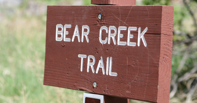
Kenosha Pass is known for its stunning hiking trails, which are particularly popular in the fall due to the vibrant autumn colors. Here are a couple of well-known trails in the area:
1. Kenosha Pass North Trail (Colorado Trail)
- Distance: Approximately 6 miles round trip.
- Features: This trail is part of the Colorado Trail and is known for its breathtaking fall foliage, expansive meadows, and views of the South Park Valley.
- Difficulty: Moderate.
- Note: It’s popular among mountain bikers and hikers alike.
2. Kenosha Pass to Georgia Pass
- Distance: Roughly 12 miles round trip.
- Features: This trail offers a mix of aspen groves and alpine landscapes, providing stunning views and varied scenery.
- Difficulty: Moderate to Strenuous due to the length and elevation gain.
3. Kenosha Pass West Trail
- Distance: Varies, but often hiked for about 6-7 miles round trip.
- Features: This trail is visited for its dense aspen groves, making it a hotspot during the fall. It also provides beautiful views of distant mountain ranges.
- Difficulty: Easy to Moderate.
4. Kenosha East Trail
- Distance: Approximately 10 miles round trip.
- Features: This trail offers a peaceful hike through lush forests and meadows, with opportunities to spot wildlife.
- Difficulty: Moderate.
These trails offer a variety of experiences for hikers of different skill levels, from tranquil walks through aspen groves to more challenging treks to higher elevations.
Kenosha Pass Camping
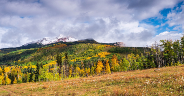
Kenosha Pass is a sought-after destination for campers due to its stunning natural beauty, particularly in the fall when the aspen trees turn a vibrant yellow.
The pass offers quite a few opportunities for camping. It’s right along the Colorado Trail, so you’ll already have a fair share of through hikers finding their place among the camp spots, but they’re typically traveling this route during the summer months (and not the fall).
Whether you want to rough it with dispersed camping or an official campground, you have options. Here’s a general guide to camping in the area:
Kenosha Pass Campground
- Location: Situated at the top of Kenosha Pass.
- Facilities: Basic amenities like toilets are typically available, but it’s often a more rustic camping experience.
- Accessibility: Accessible via US Highway 285.
- Popularity: It’s a well-visited spot, especially during peak fall colors, so early arrival or reservation (if available) is recommended.
- Activities: Provides easy access to trails for hiking and mountain biking.
Kenosha Pass Dispersed Camping
- Location: Areas around Kenosha Pass.
- Facilities: Generally, no facilities are available; it’s essential to be self-sufficient and follow Leave No Trace principles.
- Accessibility: Various spots can be found off forest service roads around the pass.
- Considerations: Check local regulations regarding dispersed camping and be mindful of fire restrictions.
When to See Kenosha Pass Fall Colors
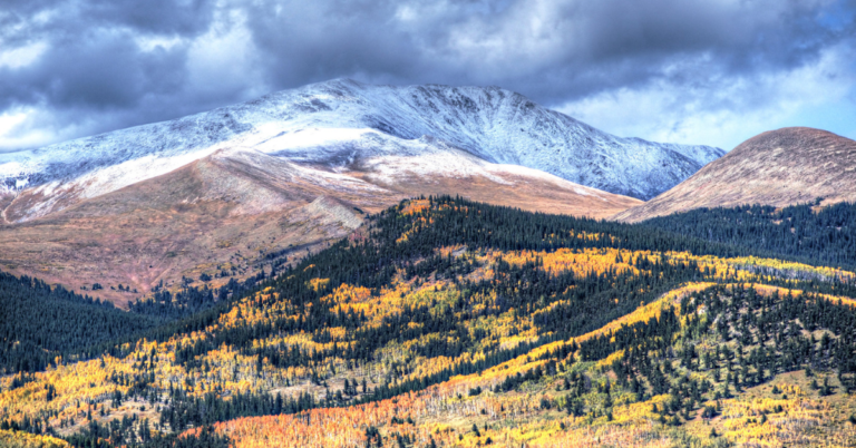
Kenosha Pass is a beautiful year-round destination, but it’s especially breathtaking when the trees turn gold in the fall. Due to its higher elevation, it begins to see the fall colors earlier than other parts of Colorado.
The timing for peak colors can vary slightly each year due to weather conditions, but the general recommendation is to visit between late September and early October to see Kenosha Pass fall colors in full detail.
This is typically the window when fall colors peak at Kenosha Pass. The aspens turn a brilliant yellow, creating a stunning contrast against the evergreens and the blue Colorado sky.
It’s always a good idea to check local resources or fall color reports for the most current information on the status of the fall colors in any given year.
Check Kenosha Pass Weather Conditions
When planning a trip to Kenosha Pass, it’s vital to consider the weather conditions due to its elevation and mountain environment. Here are some aspects to keep in mind:
- Variable Conditions: Weather can change rapidly, with sunny conditions potentially shifting to storms quickly.
- Elevation Impact: The higher elevation can mean cooler temperatures than in lower-lying areas, even during the summer.
- Winter Weather: Snow and icy conditions can impact travel and accessibility during winter.
- Sun Exposure: The higher altitude also means stronger UV rays, so adequate sun protection is crucial.
- Wind: It can be pretty windy, especially in exposed areas, so be prepared for wind chill and secure any camping gear tightly.
Reliable Weather Checking Resources:
- National Weather Service (NWS): The NWS provides detailed weather forecasts and alerts, ensuring you have accurate and reliable information.
- Weather.com: Weather.com and the Weather Channel app provide forecasts, radar images, and additional weather insights.
- NOAA Weather Radar: The NOAA provides radar images and detailed weather forecasts, which can be particularly useful for monitoring storm activity.
- AccuWeather: AccuWeather offers detailed forecasts, including minute-by-minute precipitation forecasts in the short term.
Kenosha Pass Webcam
The Colorado Department of Transportation (CDOT) provides a webcam to view current conditions on US 285 at Kenosha Pass. This can be particularly useful for checking road conditions during the winter.
Get Out and Explore the Unknown
Kenosha Pass is a must-see gem of Colorado. Fortunately, it doesn’t take too much hard work to access it—you just need a car and a tank full of gas.
If you’re inspired by Kenosha Pass’s natural beauty and considering landscape or architectural projects that complement such magnificent surroundings, EBD Studios specializes in creating designs that harmonize with the natural environment. Their expertise ensures that both aesthetic appeal and environmental integrity are at the forefront of every project.
Make the trip to Kenosha Pass. You won’t regret it.


