Welcome to Denver, Colorado—the Mile High City that sits at the gateway to the majestic Rocky Mountains. With stunning vistas, crisp mountain air, and vibrant running communities, running trails in Denver are an absolute haven for runners and outdoor enthusiasts.
However, cities and running trails don’t always go hand in hand. Denver isn’t your ordinary capital, though. You can find plenty of prime running trails in Denver (and nearby) that won’t take you hours to reach.
We get it. You’re busy and don’t always have time (especially before and after work) to drive to the foothills and hit the dirt. But that doesn’t mean you can’t get a good workout in on some of the state’s finest paved and unpaved routes.
Below, we’ll walk you through all the best running routes in Denver that’ll satisfy your runner’s itch.
Must-Know Before Running in Denver
Before you set off on your running adventure in Denver, here are a few tips to ensure a safe and enjoyable experience:
- Altitude Considerations: Denver’s elevation, famously known as the Mile High City, can impact your running performance. Take it easy during the first few days to allow your body to acclimate.
- Hydration and Sun Protection: The combination of high elevation and abundant sunshine means you’ll need to stay well-hydrated during your runs. Carry a water bottle, and consider wearing a hat, sunglasses, and sunscreen to protect yourself from the intense UV rays.
- Check the Weather: Denver’s weather can be unpredictable, even during the warmer months. Before heading out, check the weather forecast to dress appropriately and be prepared for any sudden changes in conditions.
- Respect the Trails: Denver takes pride in its natural spaces, so always follow Leave No Trace principles and respect trail rules. Stay on marked paths, avoid disturbing wildlife, and pack out any trash you may have.
- Plan for Variations in Terrain: Denver offers a wide range of running trails, from flat urban paths to steep mountain terrain. Be prepared for variations in elevation, surfaces, and difficulty levels depending on your chosen route.
- Share the Trails: Many of Denver’s trails are multi-use, so be mindful of other users, such as hikers, cyclists, and dog walkers. When necessary, yield the right of way and maintain a friendly and respectful attitude.
The Best Running Trails in Denver, Colorado
We’re going to be sticking to running trails in and near Denver. We know you’re looking for paths to hit in the morning or after work, and that doesn’t usually afford the time to drive over to Boulder, Highlands Ranch, or even Golden.
You need running trails closer than that. That’s why we’re going to focus on routes and trails within a ~10-mile radius of Downtown Denver that you can get to in (hopefully) less than 20 minutes. Of course, that’ll look different if you’re driving from Wheat Ridge to Aurora, but we’re doing our best here.
Without further ado, let’s explore the best running trails in Denver.
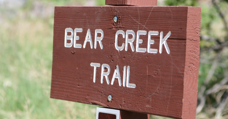
1. Cherry Creek Trail
- Type: Point-to-point, urban trail
- Distance: 25.0 miles from downtown Denver to Cherry Creek State Park
- Elevation Gain: Mostly flat with minimal elevation gain
- Surface: Paved, well-maintained pathway suitable for running and cycling
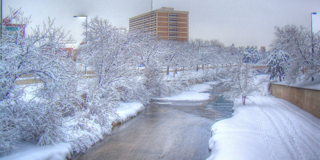
Running alongside the scenic Cherry Creek, this well-maintained, paved pathway offers a delightful escape into Denver’s heart while providing picturesque views of the city’s architecture and landscapes. You’ll get to run alongside a cool river for almost the entirety of the trail.
One of the most appealing aspects of the Cherry Creek Trail is its accessibility and convenience. With various entry points within Denver, it’s a popular choice for both locals and visitors. The trail passes near numerous attractions, shops, and restaurants, making it an excellent opportunity for runners to explore the city before or after their run.
It caters to runners of all levels, offering a mostly flat surface with minimal elevation gain, making it perfect for beginners looking for a leisurely jog or seasoned runners seeking a longer, uninterrupted route.
2. Washington Park Loop
- Type: Loop, urban park trail
- Distance: 2.6 miles
- Elevation Gain: Minimal elevation gain, mostly flat with gentle slopes
- Surface: Paved pathway and some gravel sections
Washington Park, affectionately known as “Wash Park” among the locals, provides an inviting 2.6-mile loop trail. This urban oasis is a runner’s paradise in the heart of Denver. The loop encircles Smith Lake and Grasmere Lake, allowing you to figure eight throughout the park or stick to the perimeter.
The park’s amenities include benches, water fountains, and restroom facilities. It also has plenty of shade to keep you cool during summer.
Want to add some variety to your run? Wash Park also features intersecting pathways and a variety of fitness stations. You can customize your route or incorporate additional exercises into your workout for a high-intensity interval training (HIIT) session.
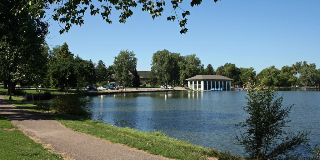
3. Sloan’s Lake Park
- Type: Loop, urban park trail.
- Distance: 2.6 miles around the lake
- Elevation Gain: Mostly flat with minimal elevation changes
- Surface: Paved pathway with some gravel sections
Sloan’s Lake Park offers a delightful 2.6-mile loop trail around the picturesque Sloan’s Lake, making it a popular choice for runners seeking a serene escape within Denver’s city limits. The flat terrain and minimal elevation changes make this trail suitable for all running levels.
The park’s centerpiece is Sloan’s Lake, a stunning 177-acre lake that provides a pretty backdrop for your run. Enjoy peaceful views of the water and the Denver skyline in the distance as you make your way around the lake.
Whether you’re looking for a peaceful morning run, a scenic sunset jog, or a refreshing midday workout, Sloan’s Lake Park offers a charming and rejuvenating running experience right in the heart of Denver.
4. High Line Canal Trail
- Type: Point-to-point, multi-use trail
- Distance: Approximately 71 miles from Waterton Canyon to Green Valley Ranch
- Elevation Gain: Mostly flat with gradual changes in elevation
- Surface: Mostly gravel with some paved sections
The High Line Canal Trail is an iconic and extensive trail that winds through the heart of Denver’s suburbs and green spaces. This historic trail spans around 71 miles, following the path of the High Line Canal. It’s the perfect place to escape the hustle and bustle of the big city without going too far.
Yet, you can go as far as you like. Looking for a weekend long run? Check. Need something for a short out-and-back jog? Check.
The best part about the High Line Canal Trail is its landscape diversity. You’ll traverse sections shaded by mature trees, open meadows, and scenic bridges crossing the canal. The gravel surface adds to the trail’s charm, especially for city runners tired of the pavement.
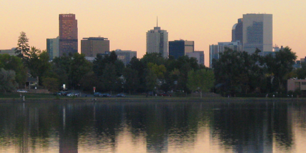
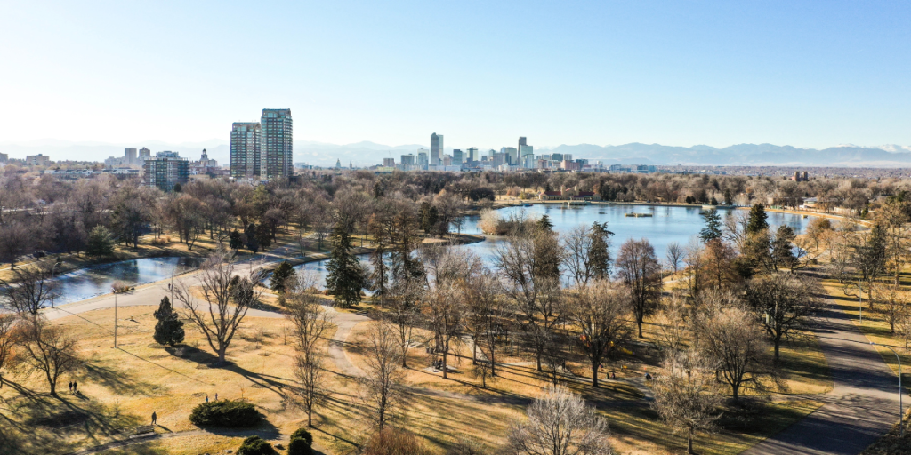
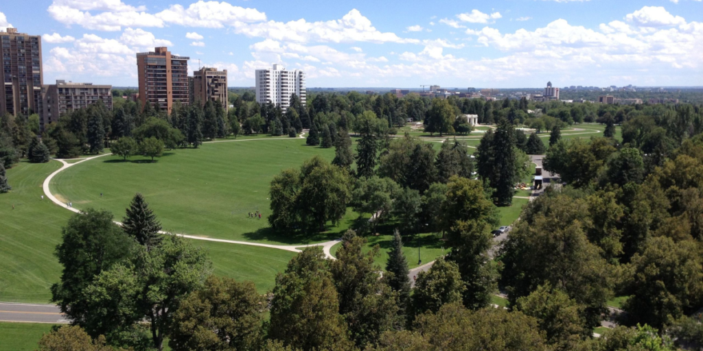
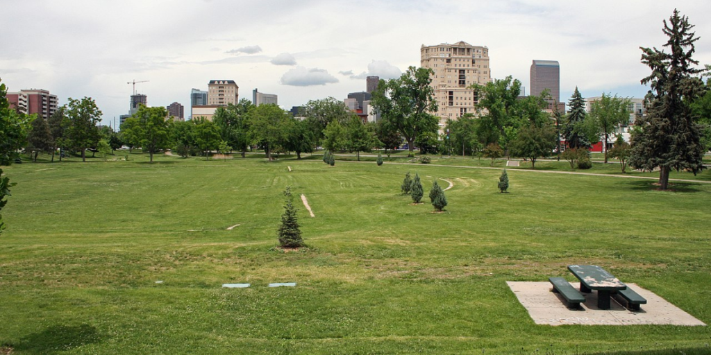
5. Denver City Park Loop
- Type: Loop, urban park trail
- Distance: 3.0 miles.
- Elevation Gain: Mostly flat with gentle slopes
- Surface: Paved pathway and some gravel sections
The Denver City Park Loop offers a refreshing 3-mile loop trail within the bustling city. The loop takes you around the expansive and well-maintained City Park, providing great views of the park’s landscapes and Ferril Lake. You’ll pass by the Denver Museum of Nature & Science and the Denver Zoo, adding to the dynamic atmosphere of the area.
Who doesn’t like to hear the calling of exotic birds and chirping chimps as they run?
There’s a little bit of shade on the trail, and there are plenty of benches to stop and take a break or stretch.
6. Cheesman Park
- Type: Loop, urban park trail
- Distance: 2.0 miles around the park’s perimeter
- Elevation Gain: Mostly flat with gentle slopes
- Surface: Paved pathway and some gravel sections
Cheesman Park is a historic urban park in the heart of Denver. You can follow the 2.0-mile perimeter of the trail and mix things up with the inner loop, too. It’s a beautiful green space with manicured lawns and nice shaded areas.
It’s an excellent park for a short run and has a bit of history. The park was once a cemetery site, which was later transformed into the beautiful public space it is today. You’ll find memorials and sculptures along the trail that pay homage to the park’s past.
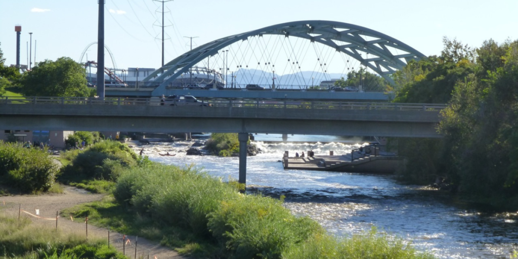
7. Platte River Trail Loop
- Type: Loop, multi-use trail.
- Distance: 3.8 miles
- Elevation Gain: Mostly flat
- Surface: Paved pathway and some gravel sections
The Platte River Trail Loops takes you from the City of Cuernavaca Park to the Gates Crescent Park, letting you run on both sides of the Platte River as you make your way around. It’s close to Union Station, making it a great place for a waterfront run before (or after) you catch the train or bus.
This scenic route is an integral part of the South Platte River multi-use trail and seamlessly connects with the Cherry Creek Trail at the southeastern point of Confluence Park. The seamless integration of trails lets you continue your run uninterrupted, allowing you to explore more from a central location.
8. Ruby Hill Park
- Type: Loop, urban park trail
- Distance: 1.6 miles
- Elevation Gain: Some elevation gain with gentle slopes
- Surface: Paved pathway and some natural surface sections
Ruby Hill Park is better known for mountain biking trails and winter recreation, but it also has some fun running trails. The park’s elevated position allows for uninterrupted and awe-inspiring views, making it a popular spot for daytime and sunset runs.
9. Clear Creek Trail
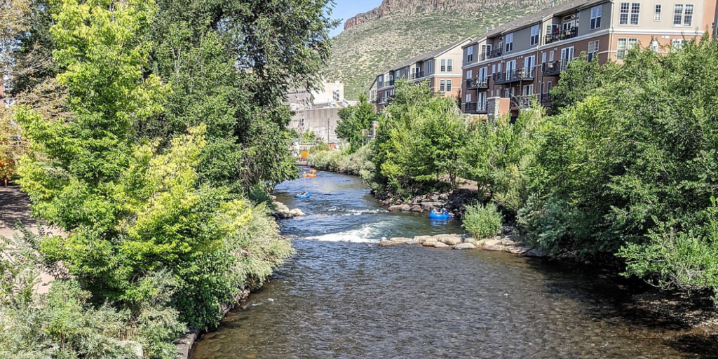
- Type: Point-to-point, multi-use trail
- Distance: Approximately 20 miles from Golden to northeast Denver
- Elevation Gain: Mostly flat with gradual changes in elevation
- Surface: Paved pathway and some packed gravel sections
The Clear Creek Trail is a scenic and diverse multi-use trail that winds its way for approximately 20 miles from Golden to northeast Denver, following the course of Clear Creek. It blends nature and urban, providing an excellent experience for casual jogs or weekend long runs.
The Clear Creek Trail is also popular among cyclists, walkers, and families, adding to the vibrant and friendly atmosphere along the route. One of the highlights of this trail is its connection to various parks and recreational areas. You’ll pass through charming neighborhoods and urban parks, offering opportunities to explore and enjoy these spaces’ amenities.
Also, the Clear Creek Trail serves as a connector to other trails, such as the Platte River Trail, providing plenty of options for longer and more adventurous runs.
10. Sand Creek Regional Greenway
- Type: Point-to-point, multi-use trail
- Distance: Approximately 12 miles from Aurora to northeast Denver
- Elevation Gain: Mostly flat with gradual changes in elevation
- Surface: Paved pathway and some packed gravel sections
This greenway follows the course of Sand Creek, providing runners with a peaceful and immersive escape into nature within the bustling city—it’s called greenway for a reason. The Sand Creek Trail passes through tons of parks and neighborhoods, providing plenty of access points and places to take a break and stretch.
While the trail is labeled as a paved pathway, there’s a lot of gravel to it—making it perfect if you’re looking for a softer running surface or want to bust out the gravel-riding bike crew.
11. South Platte River Greenway: Confluence Park
- Type: Out-and-back, multi-use trail
- Distance: Approximately 15 miles
- Elevation Gain: Mostly flat with gradual changes in elevation
- Surface: Paved pathway and some packed gravel sections
The South Platte River Greenway starts at Confluence Park and winds south along the Platte River for approximately 7 miles before ending at Grant Frontier Park. At that point, you can cross a bridge to the other side of the river and continue your run before connecting to the Northwest Greenbelt or the Mary Carter Greenway Trail.
Whatever you pick—you have options.
12. 16th Street Mall
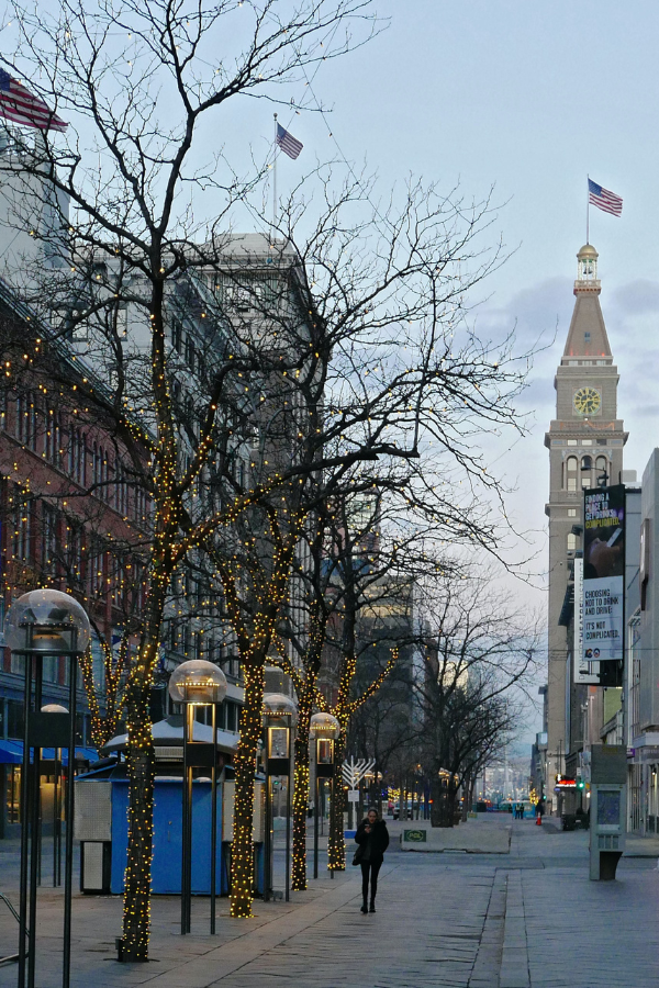
- Type: Out-and-back, pedestrian mall
- Distance: 1.25 miles
- Elevation Gain: Flat
- Surface: Paved pathway with brick and concrete sections
The 16th Street Mall is a lively and iconic pedestrian mall located in the heart of downtown Denver. Stretching approximately 1.25 miles, this urban pathway offers a unique and bustling running experience in the heart of the city.
It provides a safe and car-free environment for runners to enjoy. The flat terrain makes it accessible to runners of all levels, whether you’re looking for a quick jog or a leisurely stroll. The street has shops, restaurants, cafes, and entertainment venues. Stop and buy a drink, or fuel up for recovery after your workout.
This urban pathway also connects to various other attractions and parks in downtown Denver, allowing you to easily extend your run and explore more of the city.
13. Berkeley Lake Park
- Type: Loop, urban park trail
- Distance: 1.3 miles around the lake
- Elevation Gain: Mostly flat with gentle slopes
- Surface: Paved pathway
Berkeley Lake Park is a popular spot for local runners to hit the trails before and after work. It’s a quiet, no-thrills community for a nice peaceful nice.
The path is a combination of asphalt and concrete, so you can run on whatever feels best on your legs. Keep your eyes out for various bird species, and don’t be afraid to follow the connecting trails to other parks and neighborhoods to extend your run.
14. Rocky Mountain Lake Park
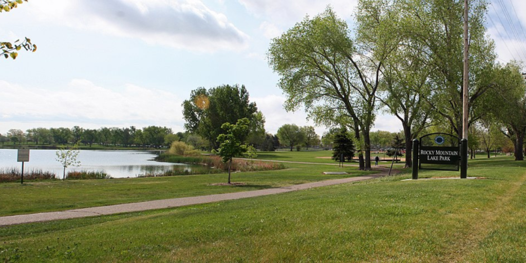
- Type: Loop, urban park trail
- Distance: 0.85 miles around the lake
- Elevation Gain: Mostly flat with gentle slopes
- Surface: Paved pathway
Just east of Berkeley Park, you’ll find Rocky Mountain Lake Park. It’s just a short mile or so around the lake, which can be perfect if you’re looking to run laps or warm up before a longer run.
15. Lakewood Gulch Trail
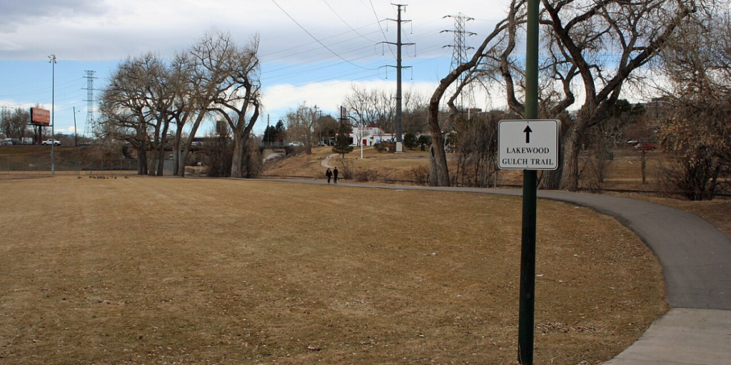
- Type: Out-and-back, urban park trail
- Distance: 3.4 miles
- Elevation Gain: Mostly flat with gentle slopes
- Surface: Paved pathway
The Lakewood Gulch Trail roughly follows Lake Gulch, connecting the South Platte River Trail on the eastern end to some baseball fields on the west end by Sheridan Blvd. The trail winds through Rude Park and Paco Sanchez Park, providing plenty of opportunities to throw in loops during your run or explore other areas.
16. Huston Lake Trail
- Type: Loop, urban park trail
- Distance: Approximately 1 mile around Huston Lake
- Elevation Gain: Mostly flat with gentle slopes
- Surface: Paved pathway
Huston Lake Trail is a charming and accessible urban park trail that encircles the scenic Huston Lake. It’s a super-flat trail perfect for setting a PR or just enjoying a stroll around the lake. The neighborhood is quiet and peaceful, allowing for an undistracted run and connecting with nature.
17. Dry Gulch Trail
- Type: Loop, multi-use trail, and streets.
- Distance: Approximately 3-4 miles
- Elevation Gain: ~175 feet
- Surface: Paved pathway, some packed gravel sections, and city streets
The Dry Gulch Trail starts at Paco Sanchez Park and winds along the W Line Trail and some neighboring sidewalks—however, you can cut through the middle on some gravel trails if you want to get your shoes dirty.
Despite being in the suburbs, you can actually find a fair bit of elevation on this route. Find the steepest hill and do some hill repeats, or get ready for those mountain races by pushing hard up the inclines.
18. Sunken Gardens Park Loop
- Type: Loop, urban park trail
- Distance: 0.75 miles
- Elevation Gain: Mostly flat with gentle slopes
- Surface: Paved pathway
The Sunken Gardens Park Loop is a short trail that winds around a little park in the city. It offers plenty of mature trees for a nice shaded afternoon run, and it easily connects with neighboring streets to extend your run and add a bit of variety.
19. The University of Denver Tour
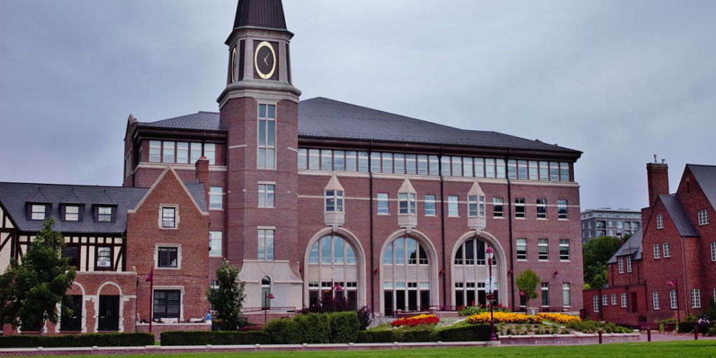
- Type: Loop
- Distance: 1.8 miles
- Elevation Gain: Mostly flat
- Surface: Paved pathway
Explore the historic University of Denver campus while getting in your miles. A nice path winds through the campus’s heart, giving you a good glimpse of some cool architectural styles and designs. Feel free to jump off the beaten path and explore other parts of the campus.
20. Weir Gulch Trail
- Type: Out-and-back
- Distance: 8.0 miles
- Elevation Gain: Mostly flat with some gradual elevation changes
- Surface: Paved pathway with some gravel sections
The Weir Gulch Trail is a segmented urban trail you can take off the South Platte River. It takes you all the way to Sheridan Boulevard, but it does have a few road crossings along the way. It’s not necessarily a scenic run, but it’s as close as you’ll get to “adventure” in the city (if you know what I mean).
Go Beyond Denver to Discover More Trails
While Denver’s got loads of running trails, it’s just a taste of what the state has to offer. You’ll have to get in your car and take a drive to experience some of the best-of-the-best trail running in Colorado and Boulder trails.
From peakbagging adventures to screaming Flatirons’ descents, experience Colorado’s best running.